ITF PROXY
| Project | ITF PROXY: from Satellite Altimeters and Gravimeters |
| Principal Investigator | R. Dwi Susanto (University of Maryland) and Y. Tony Song (Jets Propulsion Laboratory, NASA) |
| Grant | National Aeronautics and Space Administration (NASA), USA |
| Objectives | To derive proxy of Indonesian throughflow using data from satellite altimeters and gravimeters |


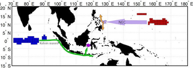
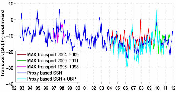
Figure (a) The total volume Indonesian throughflow transport can be estimated from sea level pressure gradient in the off-equatorial Pacific Ocean (centered at 162 E and 11 N) and equatorial Indian Ocean (80 E in the equator); (b). ITF proxy time series derived from sea level and ocean bottom pressure. [Susanto and Song, 2015].
ITF PROXY DATA
- ITF Proxy based on SSH data
- ITF Proxy based SSH & OBP data
The data is in an ascii format (N x 4 columns), where the columns 1 to 3 are dates (mm dd yyyy) and column 4 is a proxy ITF transport in Sv (1 Sv = 1 million meter cubic per second. Negative transport value denotes ITF transport toward the south or Indian Ocean)