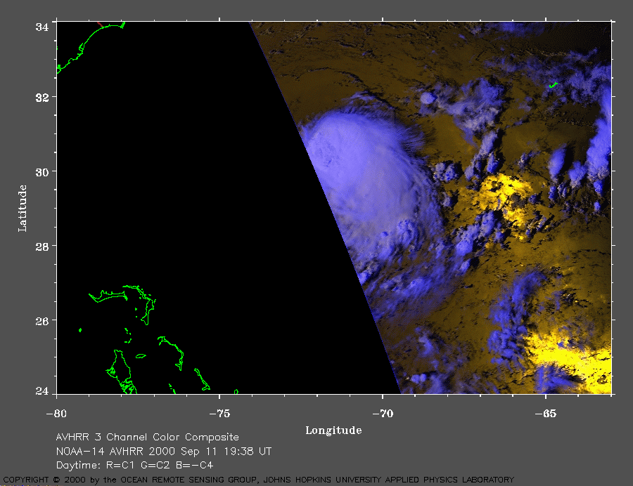
 2000 September 11 19:38 UT
NOAA-14 satellite AVHRR 3 channel color composite daytime image.
A closer view (156 Kb) is seen by clicking on this small image.
The maximum sustained winds are 70 mph at 21:00 UT.
A very large image
(585 Kb) is also available.
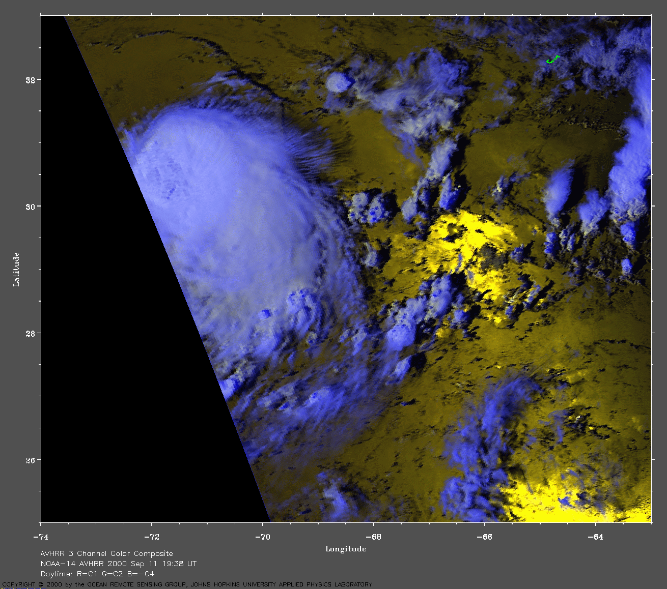
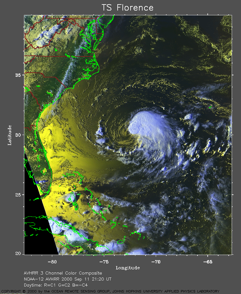 2000 September 11 21:20 UT
NOAA-12 satellite AVHRR 3 channel color composite daytime image.
A closer view (422 Kb) is seen by clicking on this small image.
A very large image
(847 Kb) is also available.
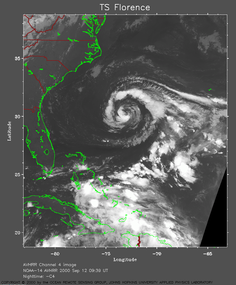 2000 September 12 09:39 UT
NOAA-14 satellite AVHRR channel 4 early morning image.
A closer view (286 Kb) is seen by clicking on this small image.
A very large image
(939 Kb) is also available.
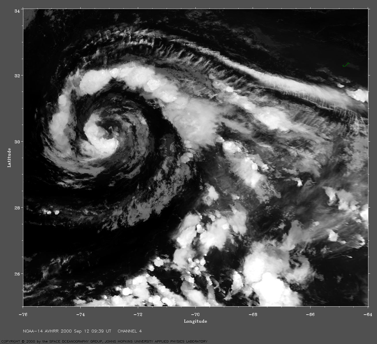
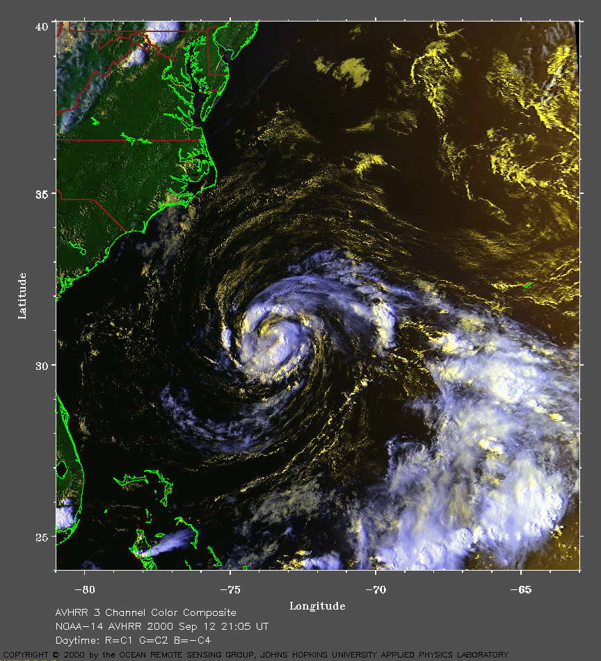 2000 September 12 21:05 UT
NOAA-14 satellite AVHRR 3 channel color composite afternoon image.
A closer view (349 Kb) is seen by clicking on this small image.
The maximum sustained winds have increased to 75 mph, making Florence a
hurricane.
A very large image
(659 Kb) is also available.
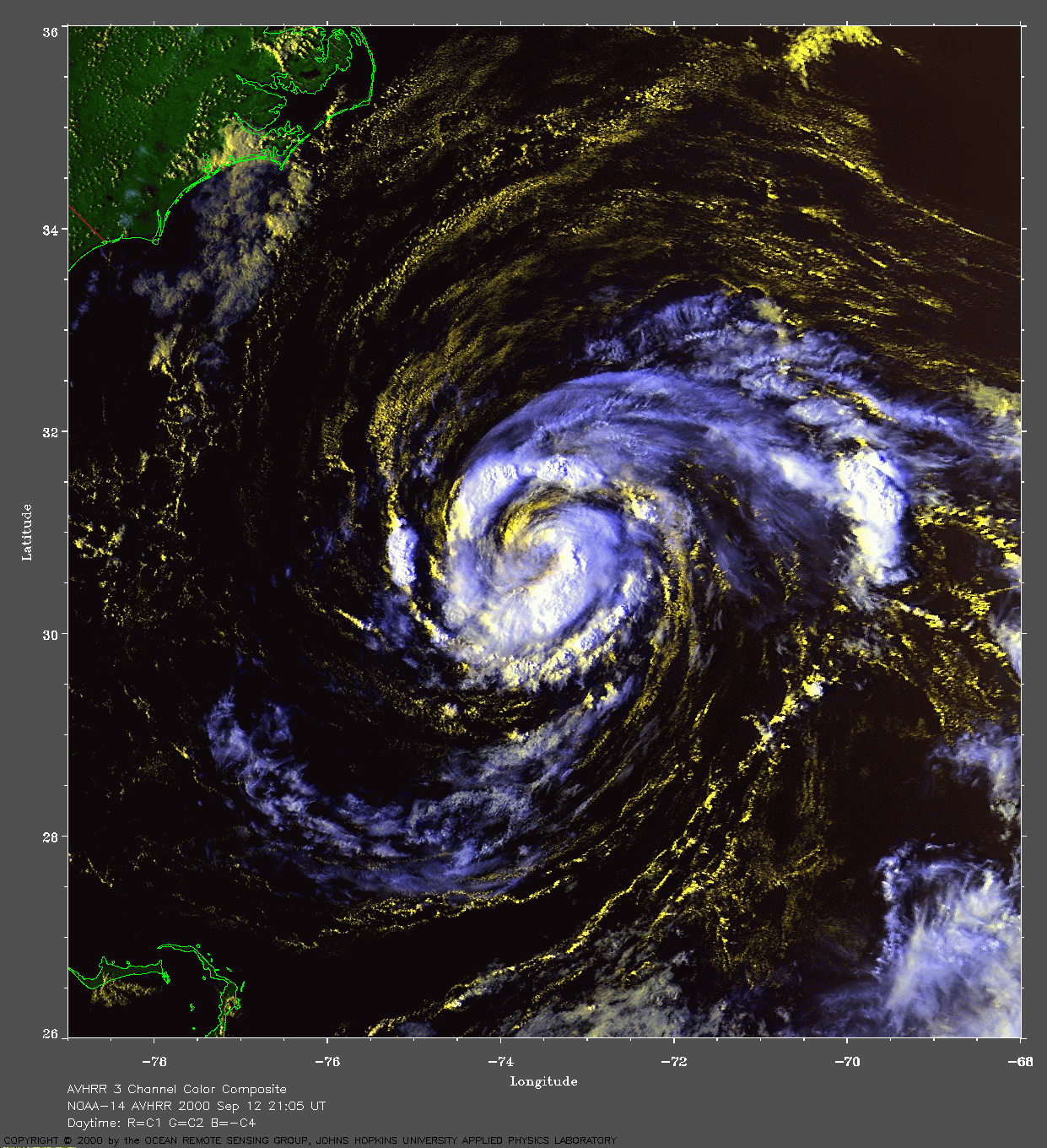
 2000 September 12 22:38 UT
NOAA-12 satellite AVHRR 3 channel color composite evening image.
A closer view (220 Kb) is seen by clicking on this small image.
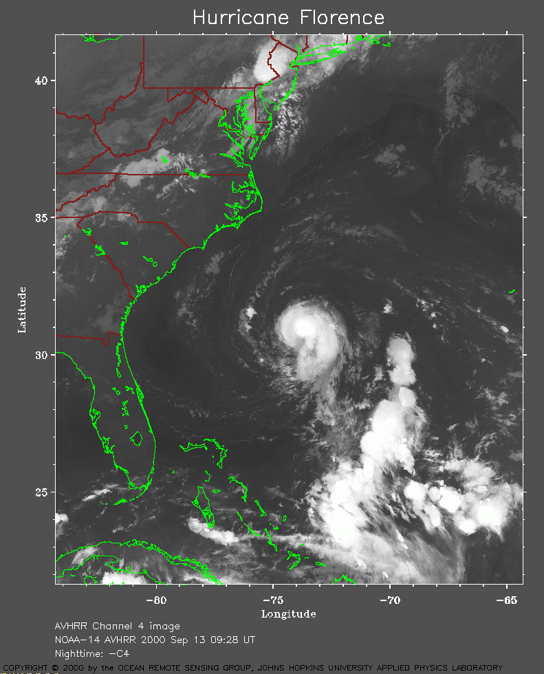 2000 September 13 09:28 UT
NOAA-14 satellite AVHRR channel 4 early morning image.
A closer view (262 Kb) is seen by clicking on this small image.
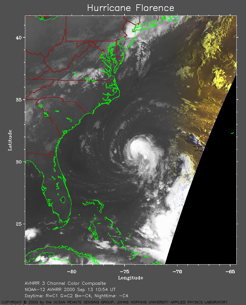 2000 September 13 10:54 UT
NOAA-12 satellite AVHRR 3 channel color composite morning image.
A closer view (219 Kb) is seen by clicking on this small image.
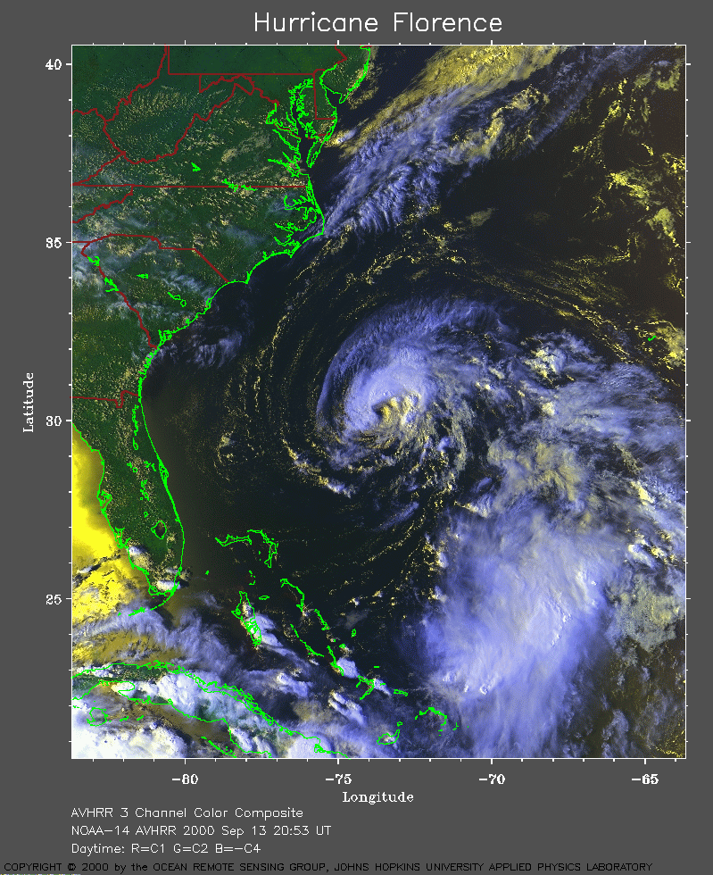 2000 September 13 20:53 UT
NOAA-14 satellite AVHRR 3 channel color composite afternoon image.
A closer view (401 Kb) is seen by clicking on this small image.
The maximum sustained winds are decreasing from 75 mph at 15:00 UT to 70
mph at 21:00 UT.
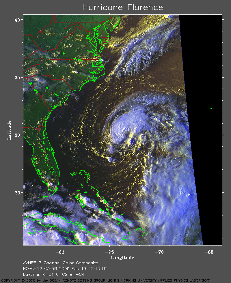 2000 September 13 22:15 UT
NOAA-12 satellite AVHRR 3 channel color composite evening image.
A closer view (362 Kb) is seen by clicking on this small image.
A very large image
(585 Kb) is also available.
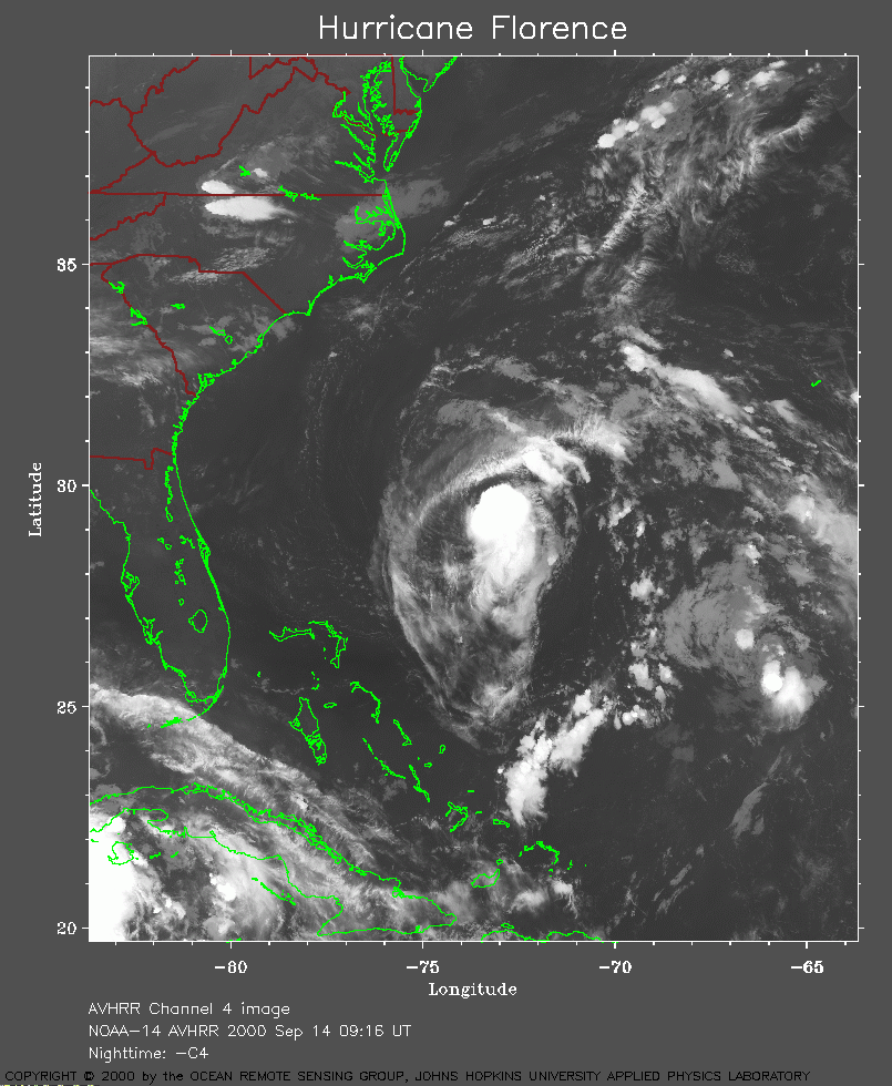 2000 September 14 09:16 UT
NOAA-14 satellite AVHRR channel 4 morning image.
A closer view (291 Kb) is seen by clicking on this small image.
The maximum sustained winds have now decreased to 60 mph.
A very large image
(1001 Kb) is also available.
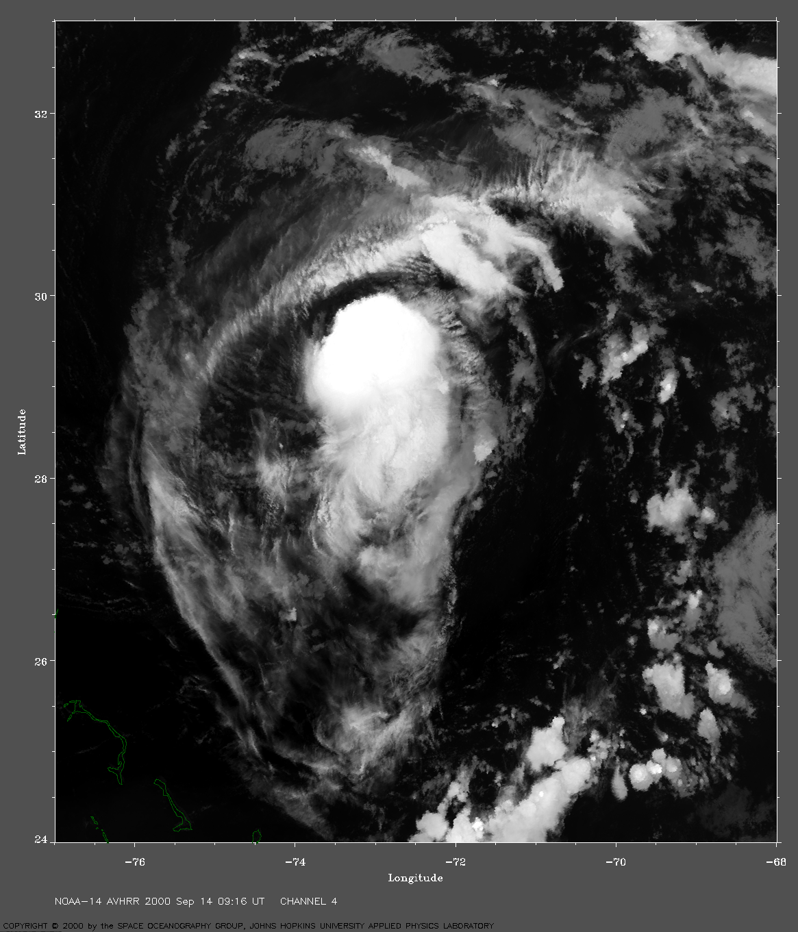
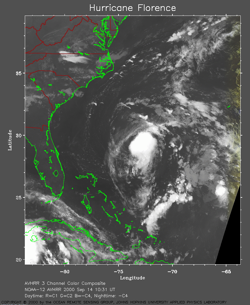 2000 September 14 10:31 UT
NOAA-12 satellite AVHRR channel 4 morning image.
A closer view (323 Kb) is seen by clicking on this small image.
A very large image
(937 Kb) is also available.
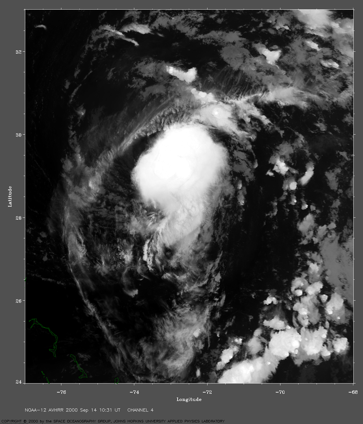
 2000 September 14 20:41 UT
NOAA-14 satellite AVHRR 3 channel color composite afternoon image.
A closer view (420 Kb) is seen by clicking on this small image.
The maximum sustained winds decreased to 45 mph at 21:00 UT.
A very large image
(966 Kb) is also available.
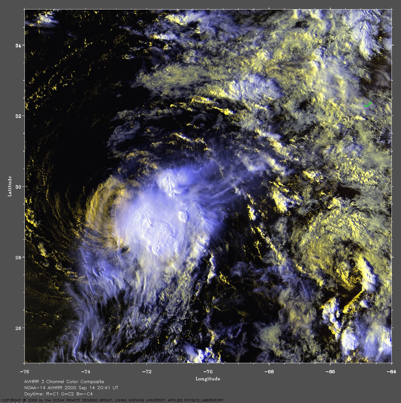
 2000 September 14 21:51 UT
NOAA-12 satellite AVHRR 3 channel color composite afternoon image.
A closer view (465 Kb) is seen by clicking on this small image.
A very large image
(773 Kb) is also available.
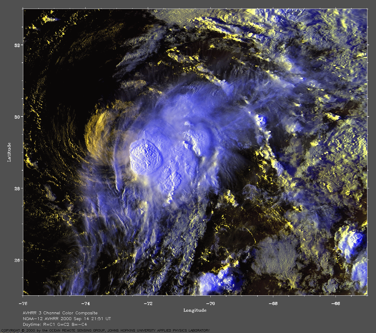
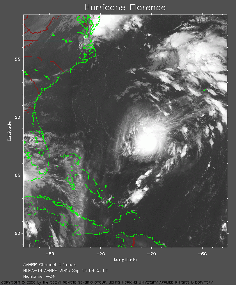 2000 September 15 09:05 UT
NOAA-14 satellite AVHRR channel 4 early morning image.
A closer view (296 Kb) is seen by clicking on this small image.
A very large image
(901 Kb) is also available.
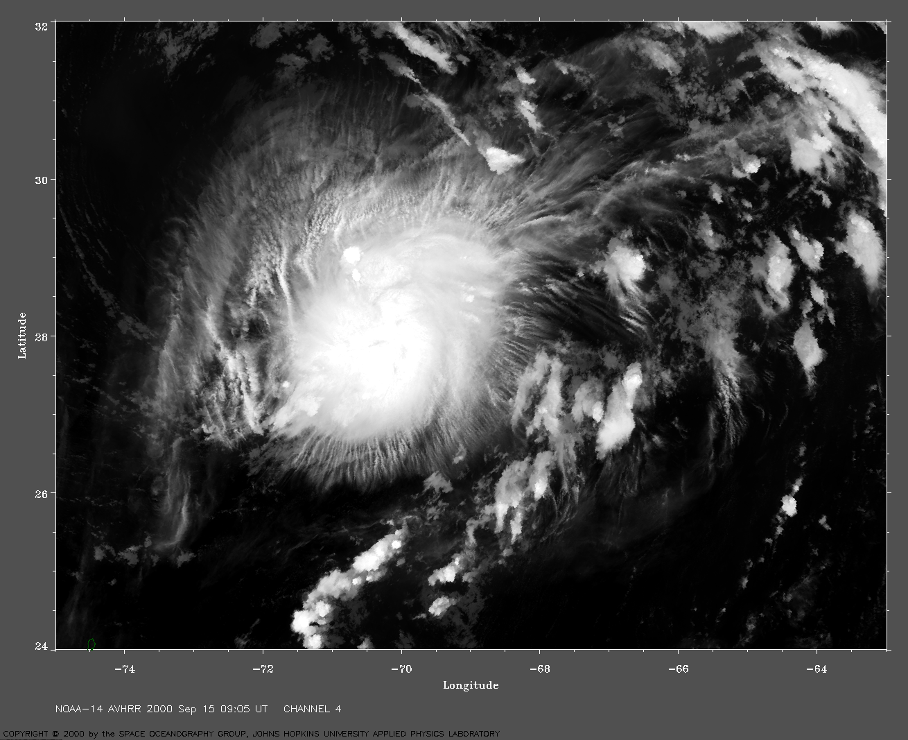
 2000 September 15 10:08 UT
NOAA-12 satellite AVHRR channel 4 early morning image.
A closer view (298 Kb) is seen by clicking on this small image.
A very large image
(895 Kb) is also available.
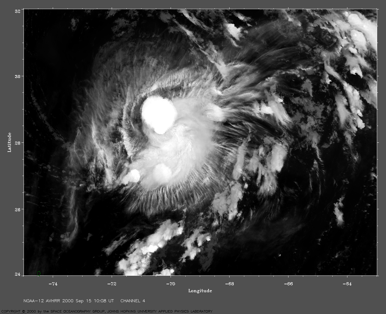
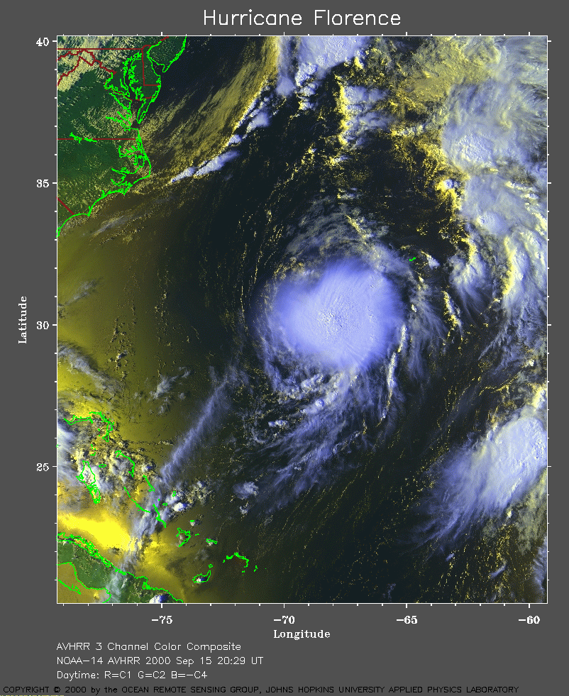 2000 September 15 20:29 UT
NOAA-14 satellite AVHRR 3 channel color composite afternoon image.
A closer view (414 Kb) is seen by clicking on this small image.
Florence is beginning to re-intensify.
A very large image
(801 Kb) is also available.
Note the island of Bermuda near the northeastern quadrant of the storm.
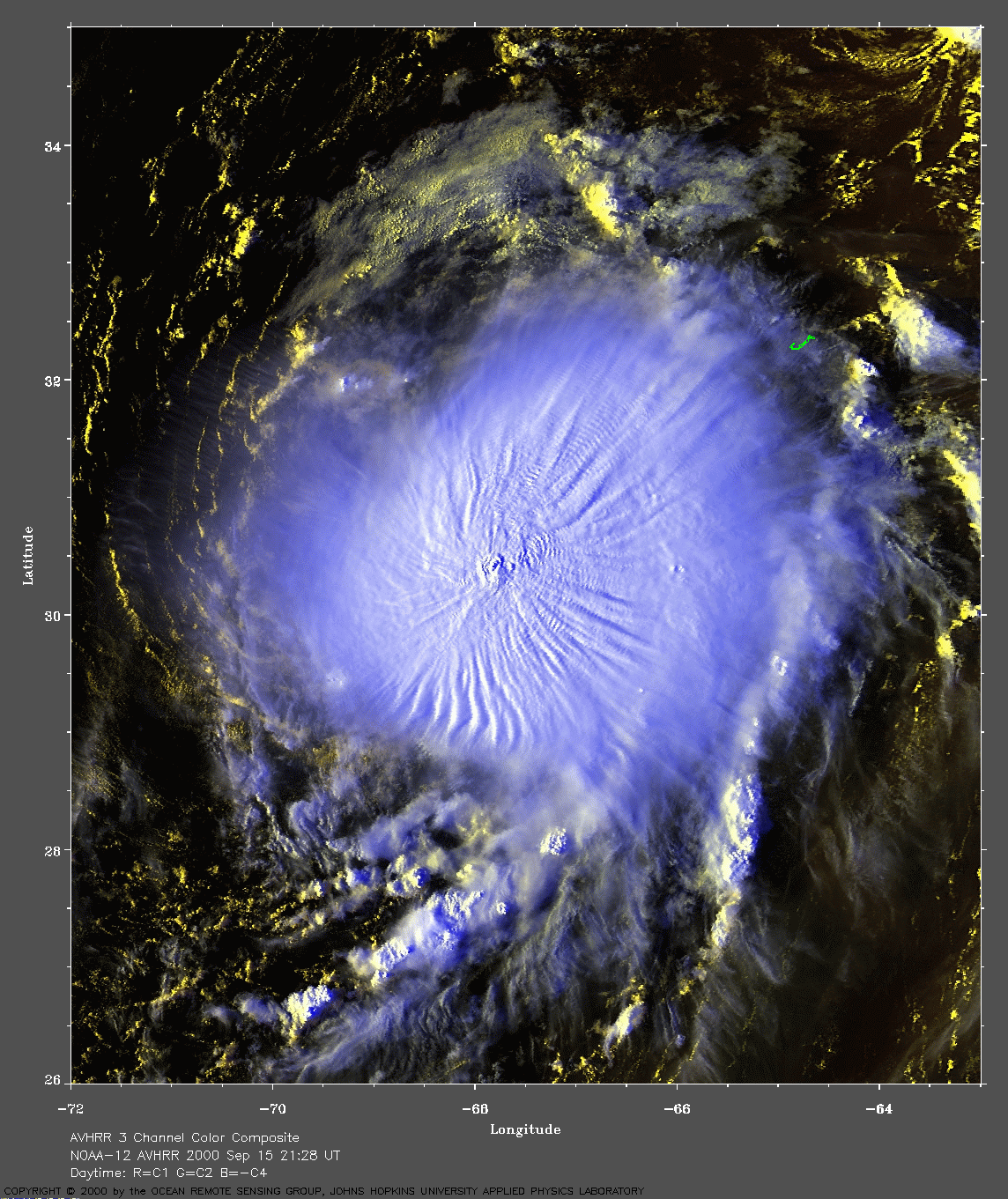
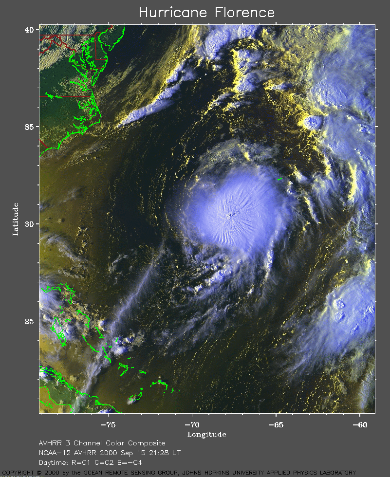 2000 September 15 21:28 UT
NOAA-12 satellite AVHRR 3 channel color composite evening image.
A closer view (440 Kb) is seen by clicking on this small image. The
maximum sustained winds will increase to 70 mph by 00:00 UT September
16.
A very large image
(741 Kb) is also available.
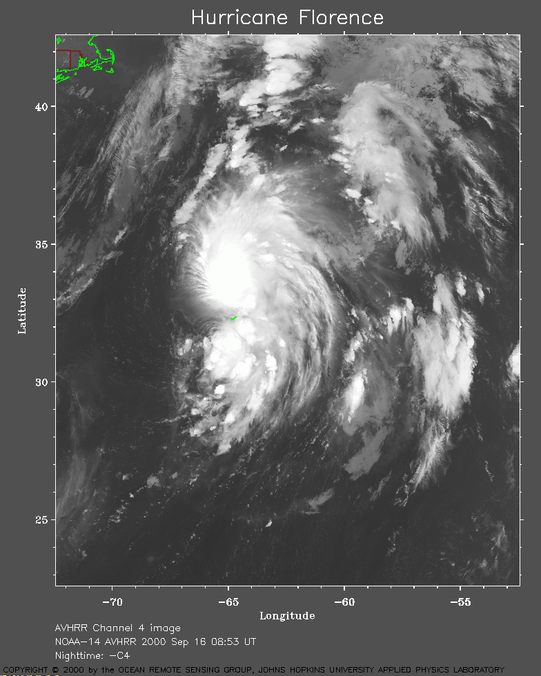 2000 September 16 08:53 UT
NOAA-14 satellite AVHRR channel 4 early morning image.
A closer view (291 Kb) is seen by clicking on this small image. The
maximum sustained winds are now 75 mph, making Florence a hurricane
again.
A very large image
(918 Kb) is also available.
Note the island of Bermuda (J-shaped) just below the center of the hurricane.
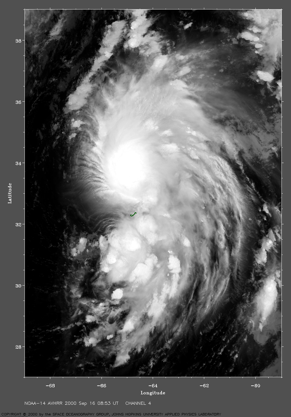
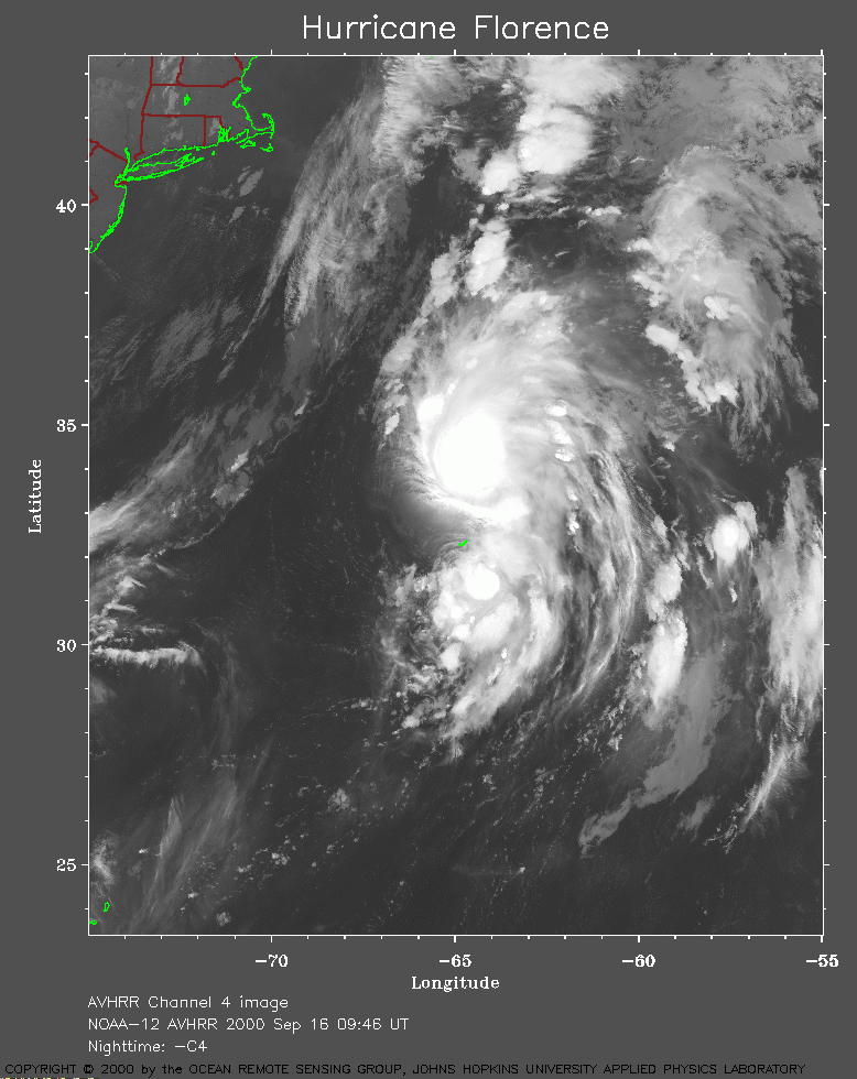 2000 September 16 09:46 UT
NOAA-12 satellite AVHRR channel 4 early morning image.
A closer view (293 Kb) is seen by clicking on this small image.
A very large image
(871 Kb) is also available.
 2000 September 16 20:18 UT
NOAA-14 satellite AVHRR 3 channel color composite afternoon image.
A closer view (402 Kb) is seen by clicking on this small image.
The maximum sustained winds are increasing to 80 mph at 21:00 UT.
A very large image
(775 Kb) is also available.
 2000 September 16 21:06 UT
NOAA-12 satellite AVHRR 3 channel color composite evening image.
A closer view (409 Kb) is seen by clicking on this small image.
A very large image
(827 Kb) is also available.
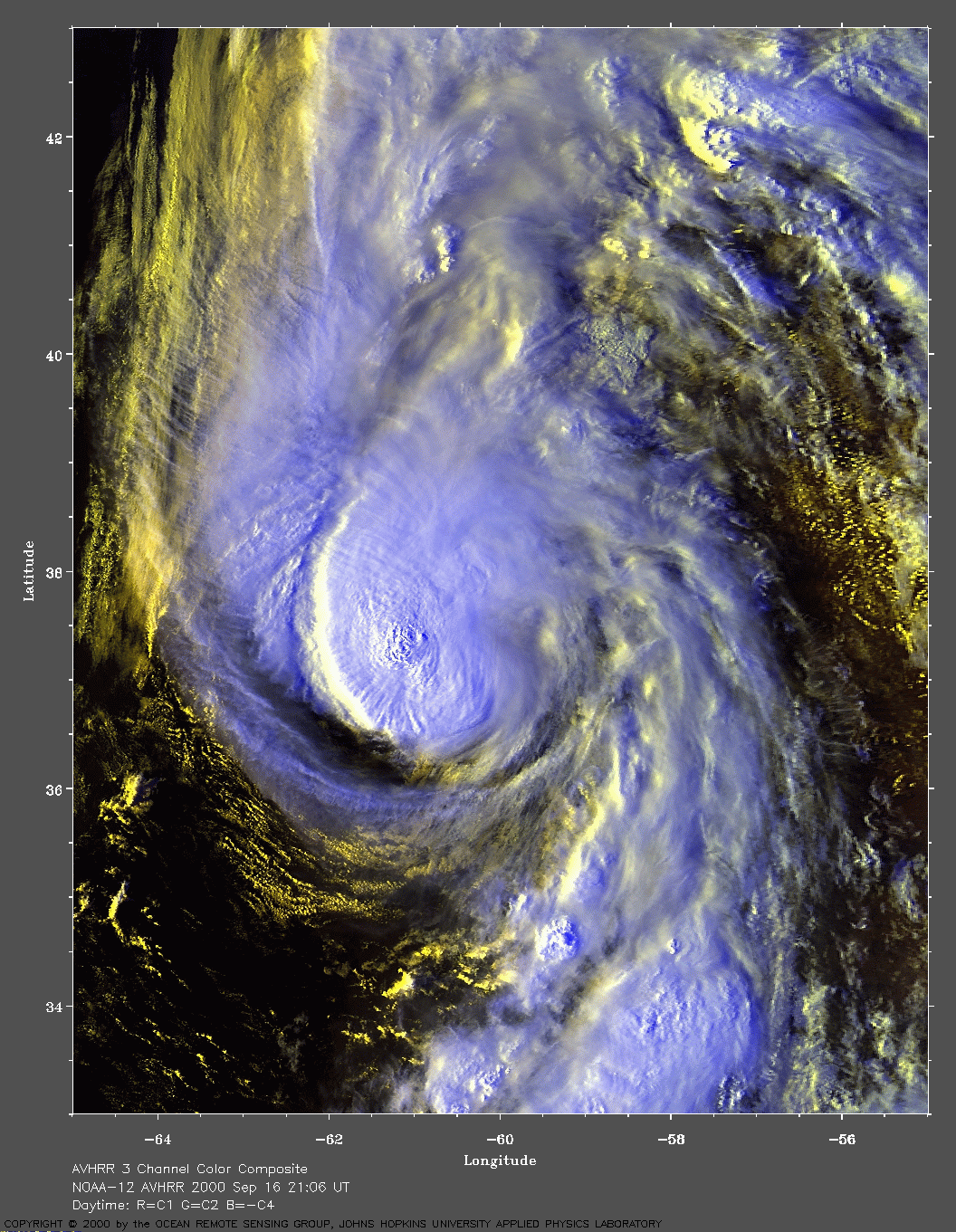
 2000 September 17 08:41 UT
NOAA-14 satellite AVHRR channel 4 early morning image.
A closer view (259 Kb) is seen by clicking on this small image.
A very large image
(926 Kb) is also available.
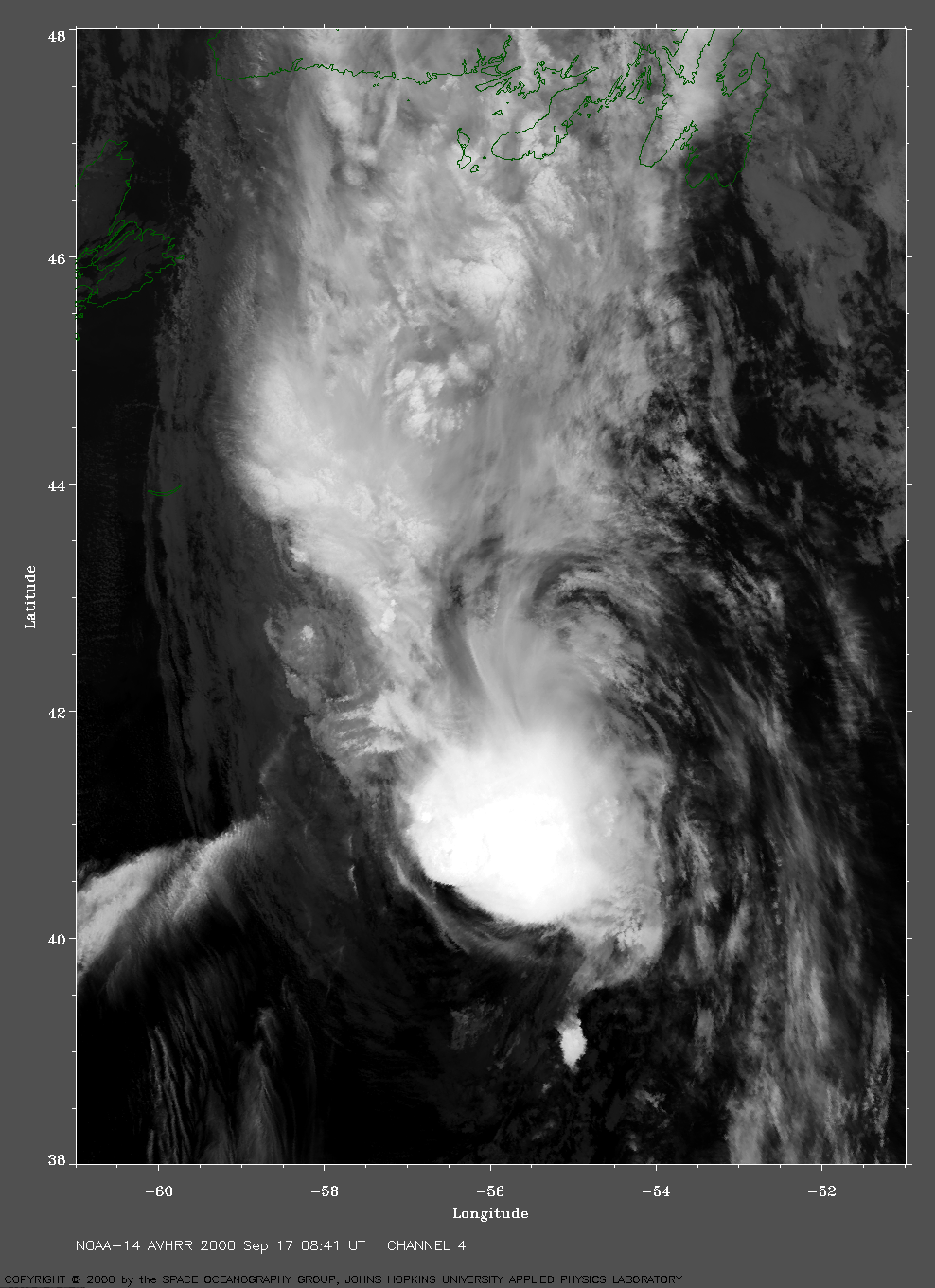
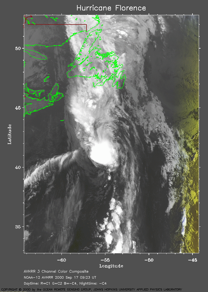 2000 September 17 09:23 UT
NOAA-12 satellite AVHRR channel 4 early morning image.
A closer view (271 Kb) is seen by clicking on this small image.
The maximum sustained winds have decreased to 65 mph.
A very large image
(924 Kb) is also available.
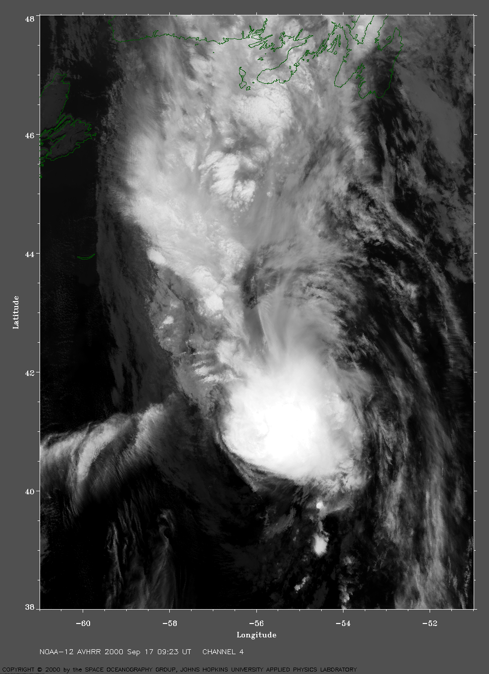
 2000 September 17 20:07 UT
NOAA-14 satellite AVHRR channel color composite afternoon image.
A closer view (262 Kb) is seen by clicking on this small image.
The maximum sustained winds have decreased to 60 mph.
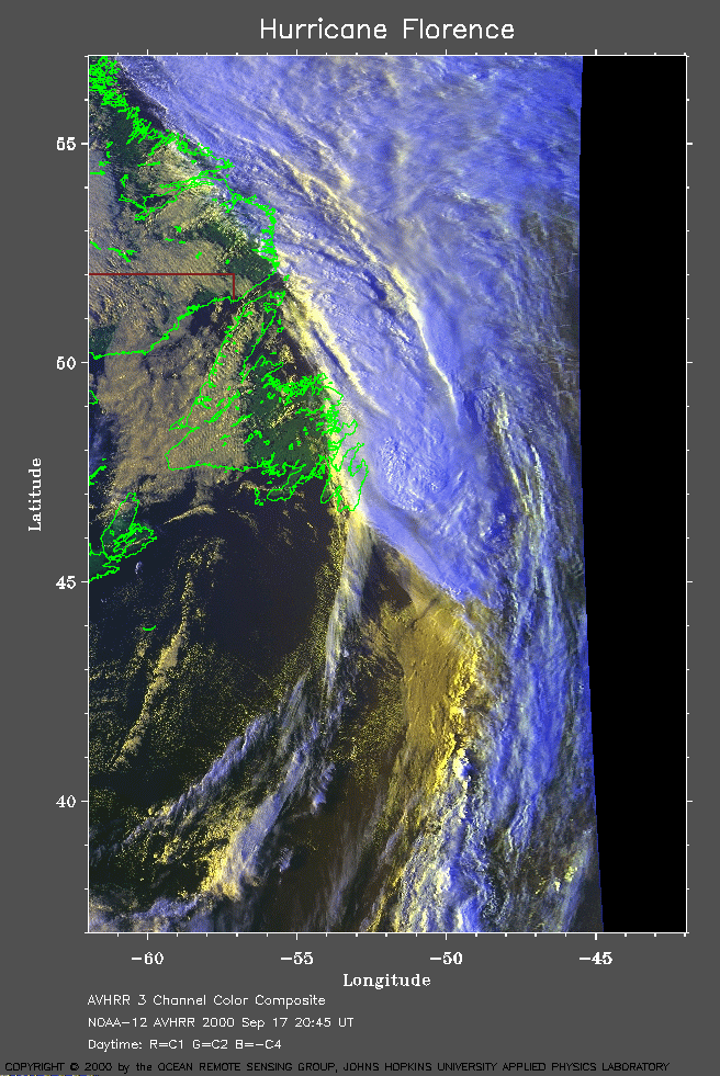 2000 September 17 20:45 UT
NOAA-12 satellite AVHRR channel color composite afternoon image.
A closer view (316 Kb) is seen by clicking on this small image.