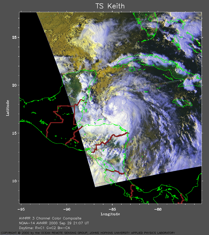
 2000 September 29 21:07 UT
NOAA-14 satellite AVHRR 3 channel color composite evening image.
A closer view (331 Kb) is seen by clicking on this small image.
The maximum sustained winds are 50 mph.
A very large image (772
Kb) is also available.
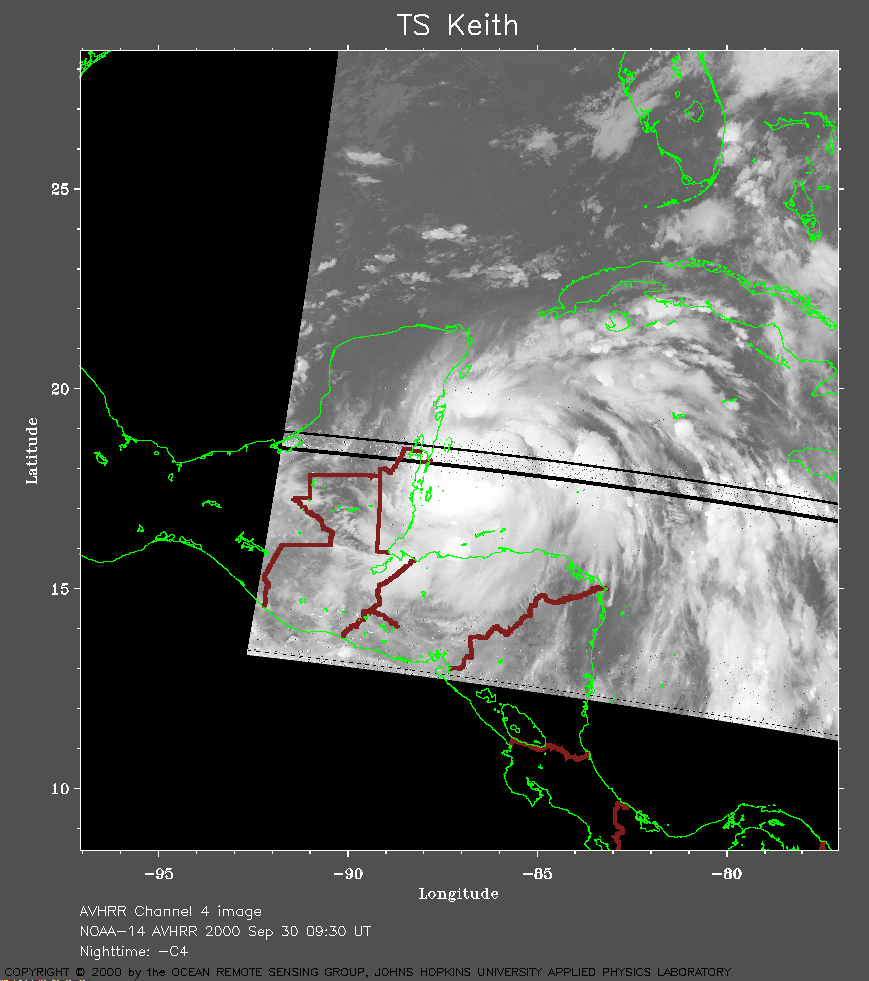 2000 September 30 09:30 UT
NOAA-14 satellite AVHRR channel 4 early morning image.
A closer view (199 Kb) is seen by clicking on this small image.
The maximum sustained winds are 70 mph.
A very large image (904
Kb) is also available.
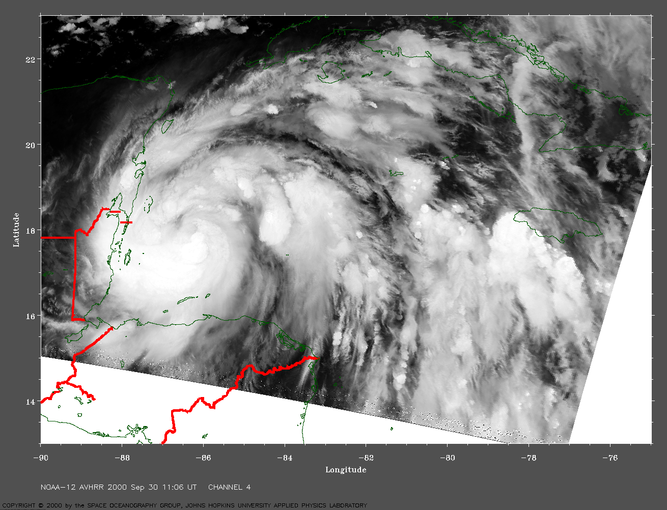
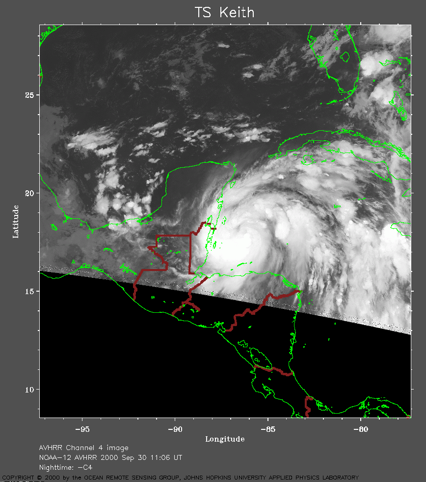 2000 September 30 11:06 UT
NOAA-12 satellite AVHRR channel 4 early morning image.
A closer view (241 Kb) is seen by clicking on this small image.
A very large image (807
Kb) is also available.
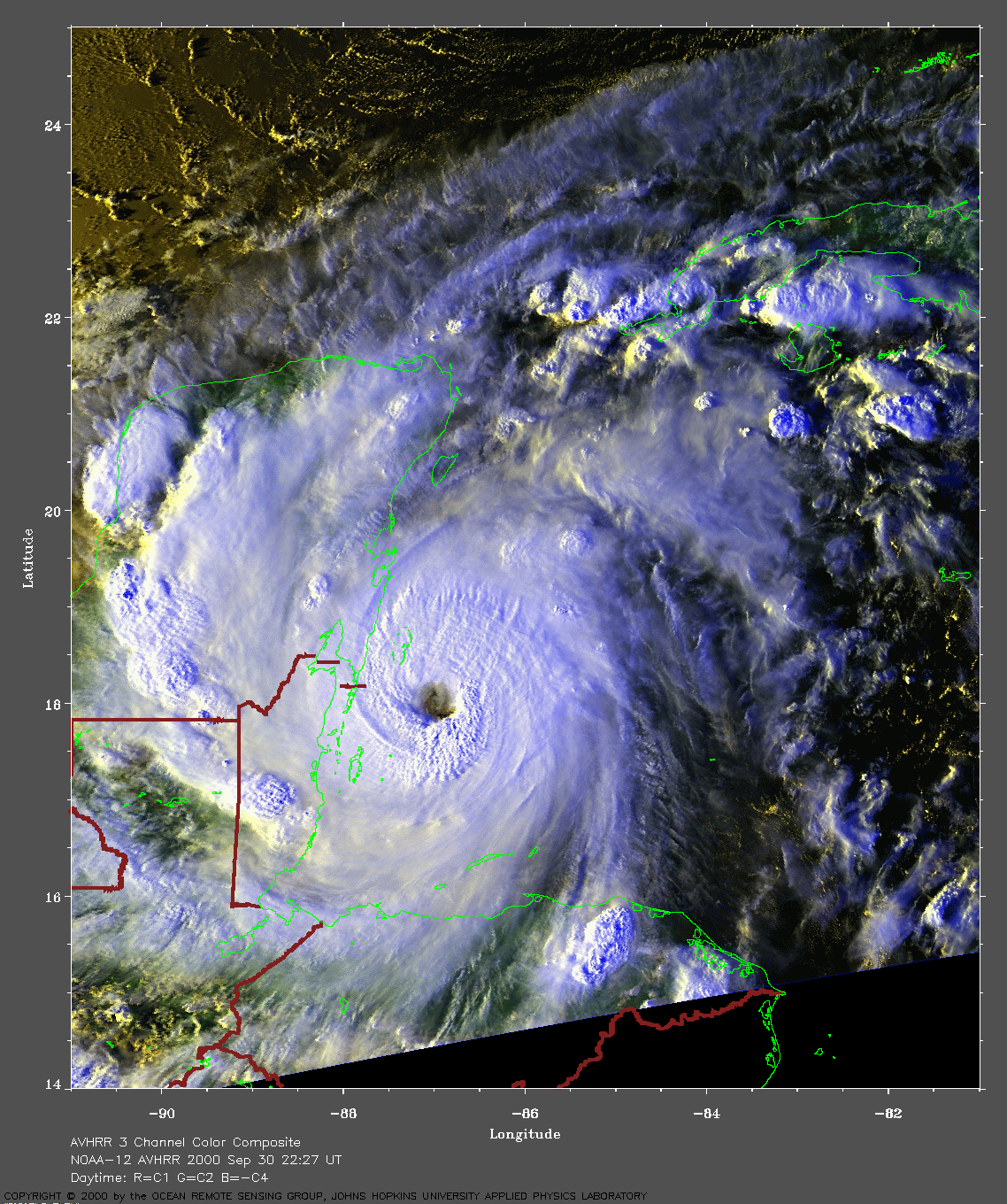
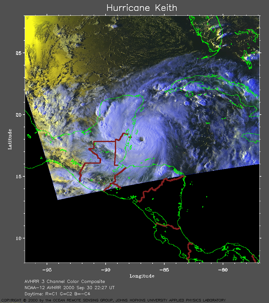 2000 September 30 22:27 UT
NOAA-12 satellite AVHRR 3 channel color composite evening image.
A closer view (325 Kb) is seen by clicking on this small image.
The maximum sustained winds have increased to 100 mph.
A very large image (847
Kb) is also available.
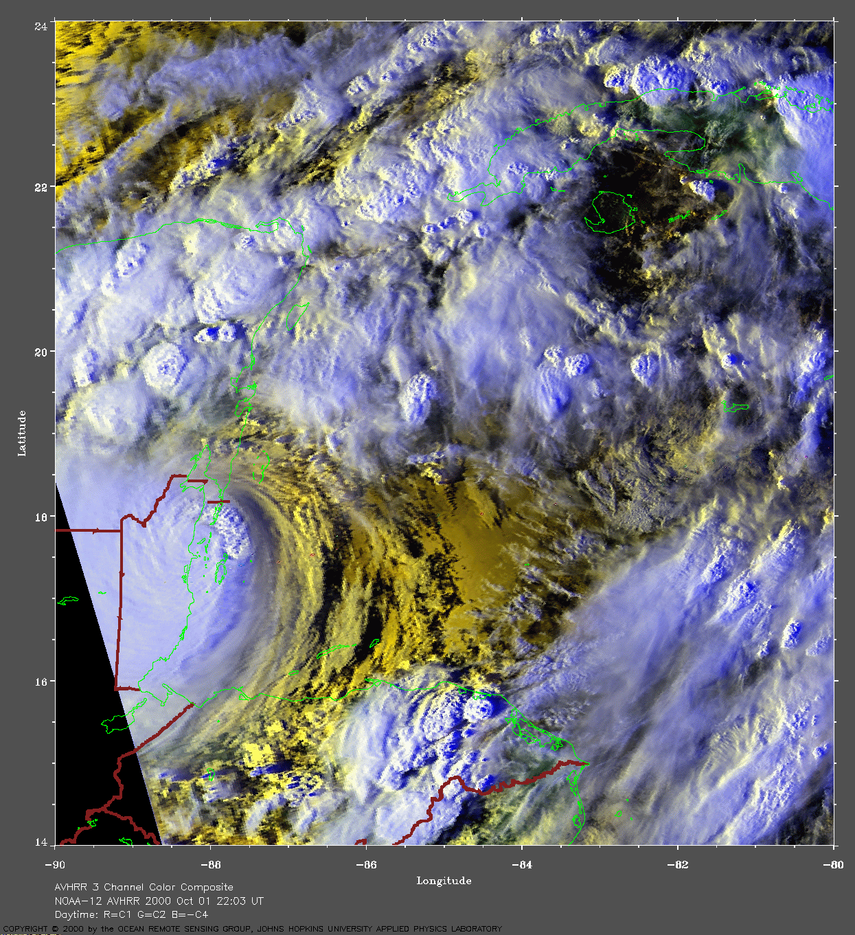
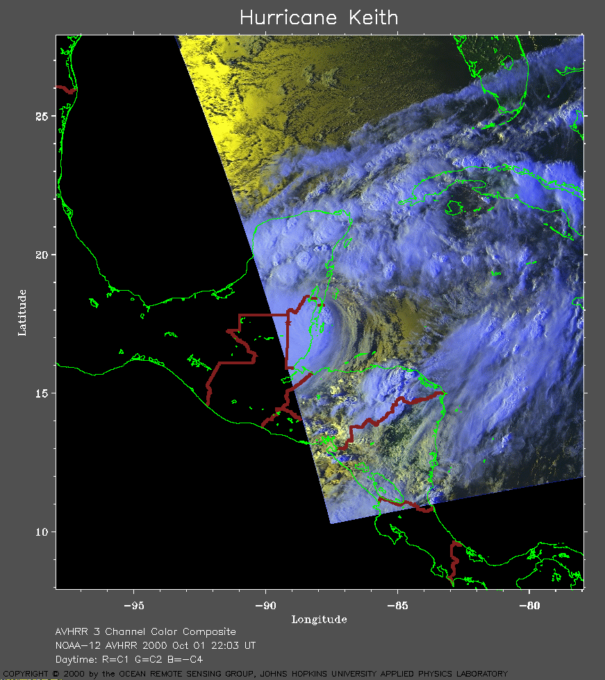 2000 October 01 22:03 UT
NOAA-12 satellite AVHRR 3 channel color composite evening image.
A closer view (281 Kb) is seen by clicking on this small image.
The maximum sustained winds are 125 mph and the eye is crossing the
coast of Belize.
A very large image (1041
Kb) is also available.
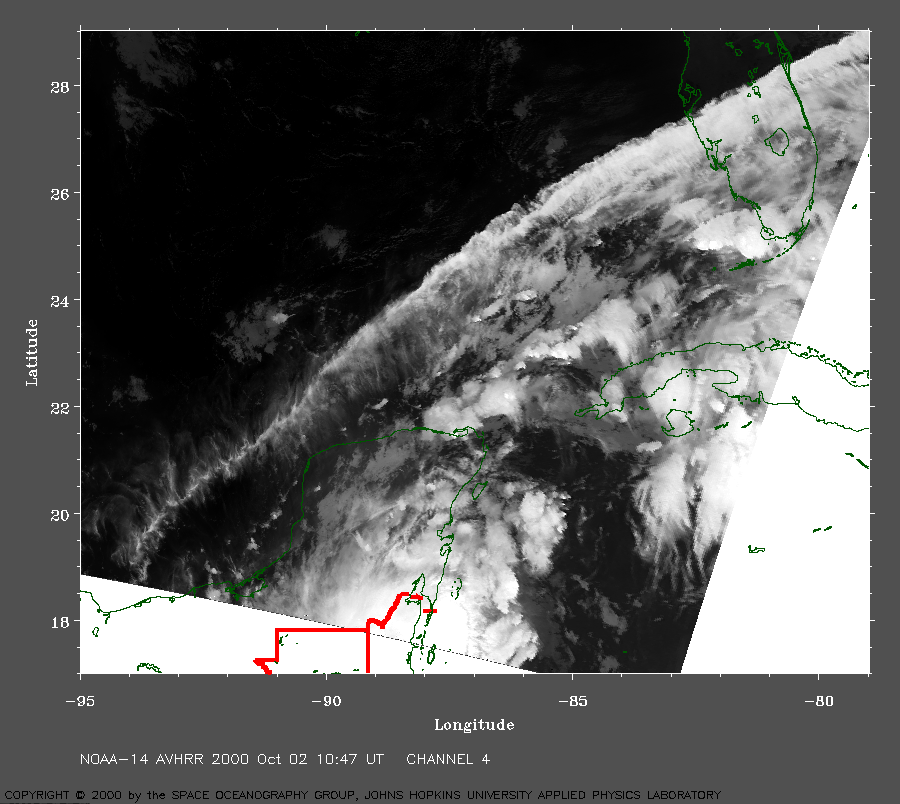 2000 October 02 10:47 UT
NOAA-14 satellite AVHRR channel 4 early morning image.
A closer view (360 Kb) is seen by clicking on this small image.
The maximum sustained winds have decreased to 100 mph.
A very large image (868
Kb) is also available.
 2000 October 02 22:15 UT
NOAA-14 satellite AVHRR 3 channel color composite evening image.
A closer view (269 Kb) is seen by clicking on this small image.
The maximum sustained winds have decreased to 75 mph.
It was reported that the winds emptied the Bay of Chetumal (on the border
between Mexico and Belize). When the eye of the storm passed over the
area, people were tempted to walk into the Bay. This was very
dangerous behavior because, once the winds relax, the water returns to
the Bay very quickly.
A very large image (755
Kb) is also available.
 2000 October 03 10:35 UT
NOAA-14 satellite AVHRR channel 4 early morning image.
A closer view (215 Kb) is seen by clicking on this small image.
The maximum sustained winds have decreased to 55 mph.
A very large image (918
Kb) is also available.
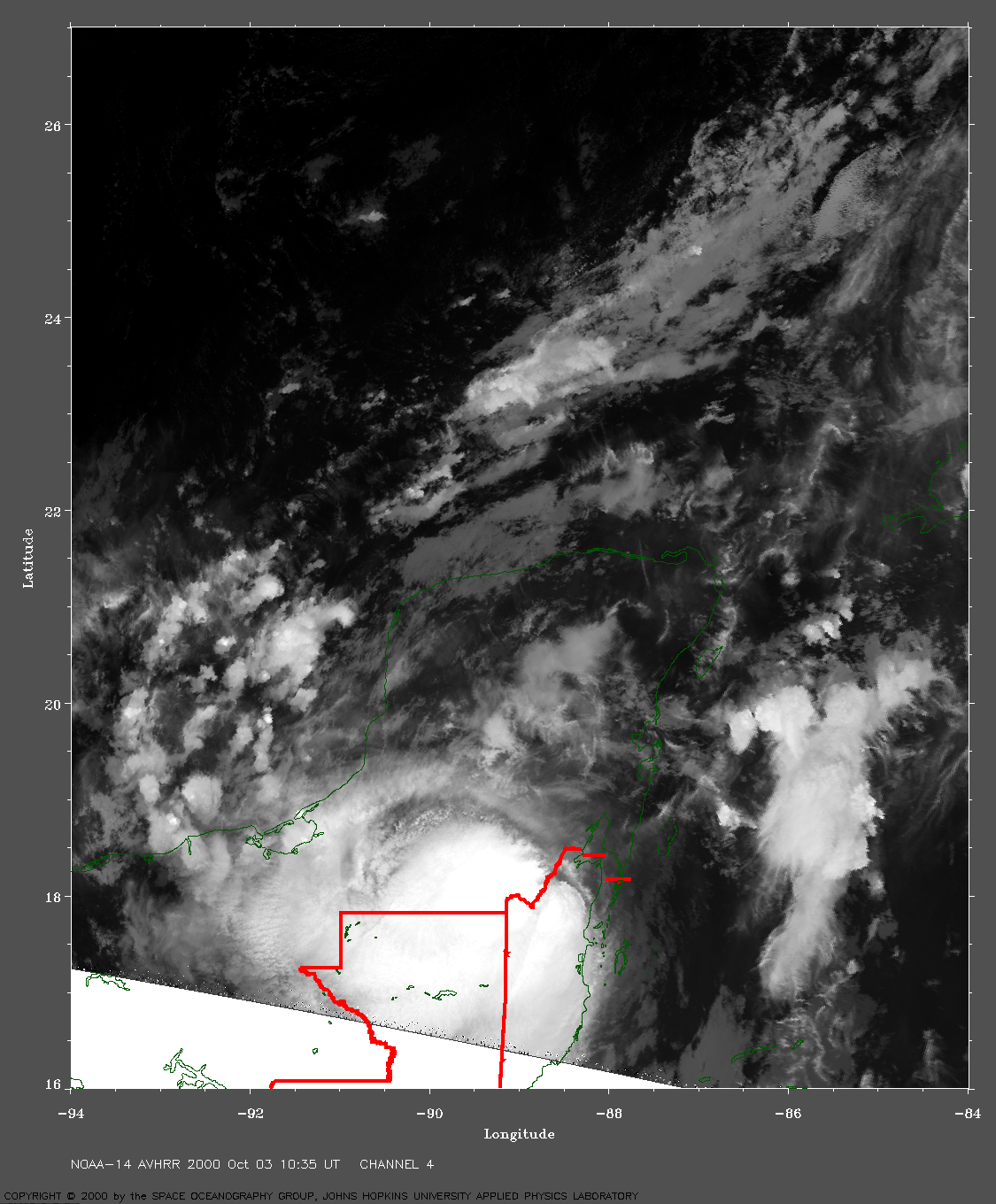
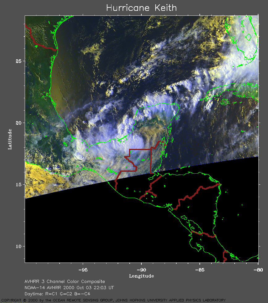 2000 October 03 22:03 UT
NOAA-14 satellite AVHRR 3 channel color composite afternoon image.
A closer view (316 Kb) is seen by clicking on this small image.
The maximum sustained winds have decreased to 30 mph.
A very large image (728
Kb) is also available.
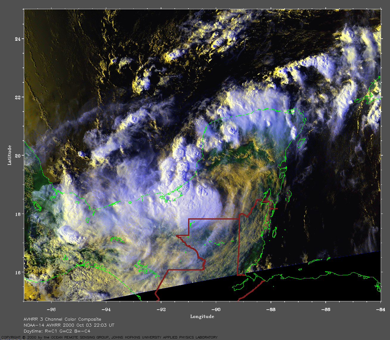
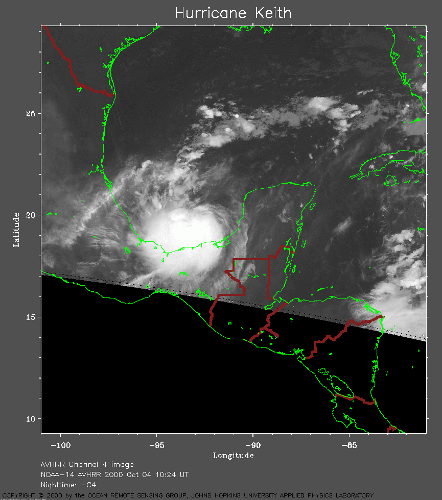 2000 October 04 10:24 UT
NOAA-14 satellite AVHRR channel 4 early morning image.
A closer view (201 Kb) is seen by clicking on this small image.
The maximum sustained winds have increased to 35 mph.
A very large image (996
Kb) is also available.
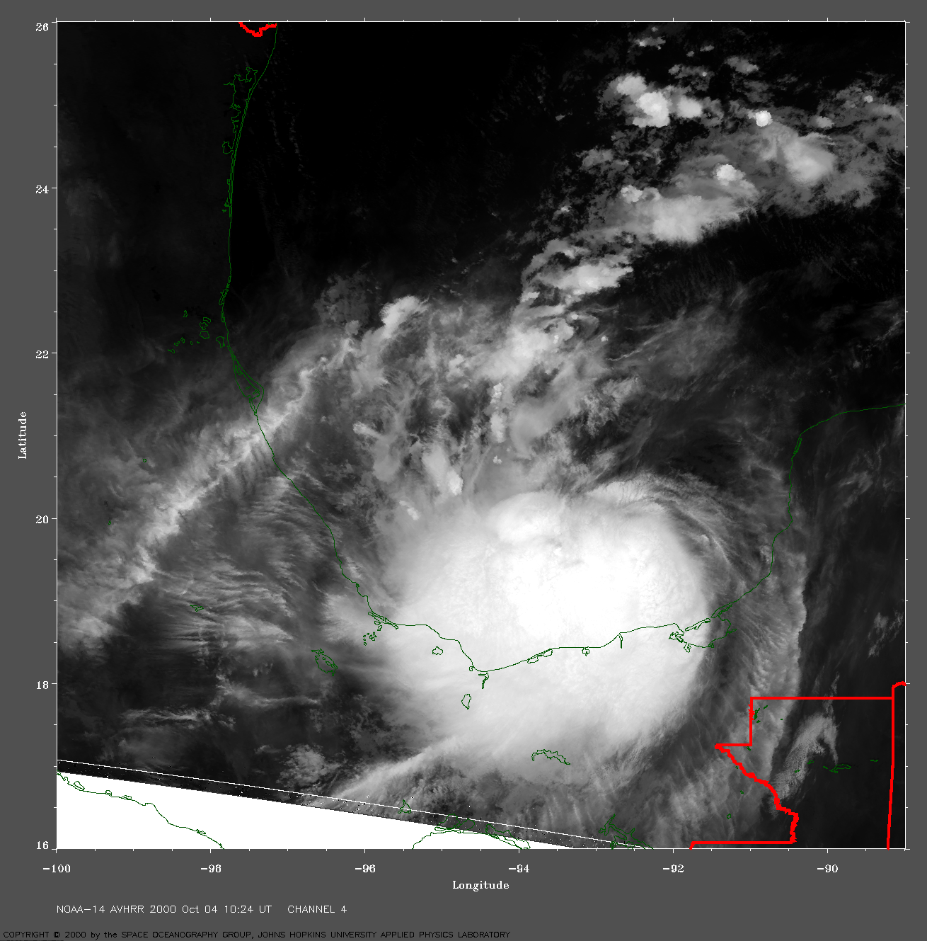
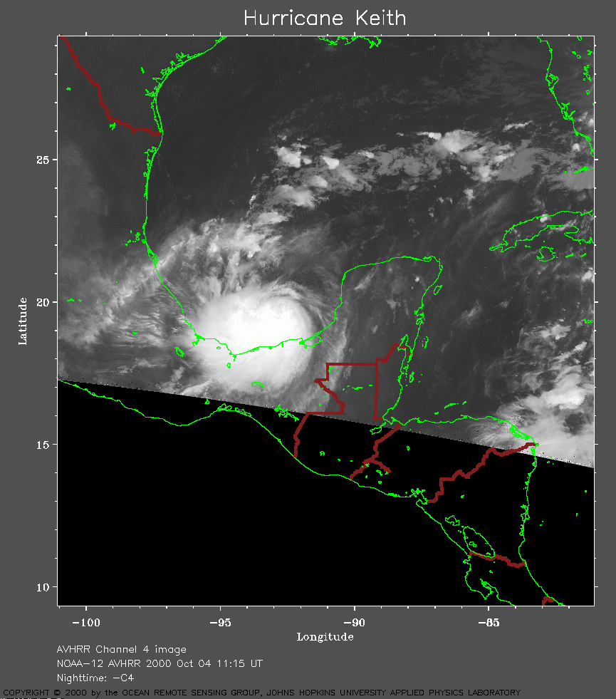 2000 October 04 11:15 UT
NOAA-12 satellite AVHRR channel 4 early morning image.
A closer view (199 Kb) is seen by clicking on this small image.
A very large image (921
Kb) is also available.
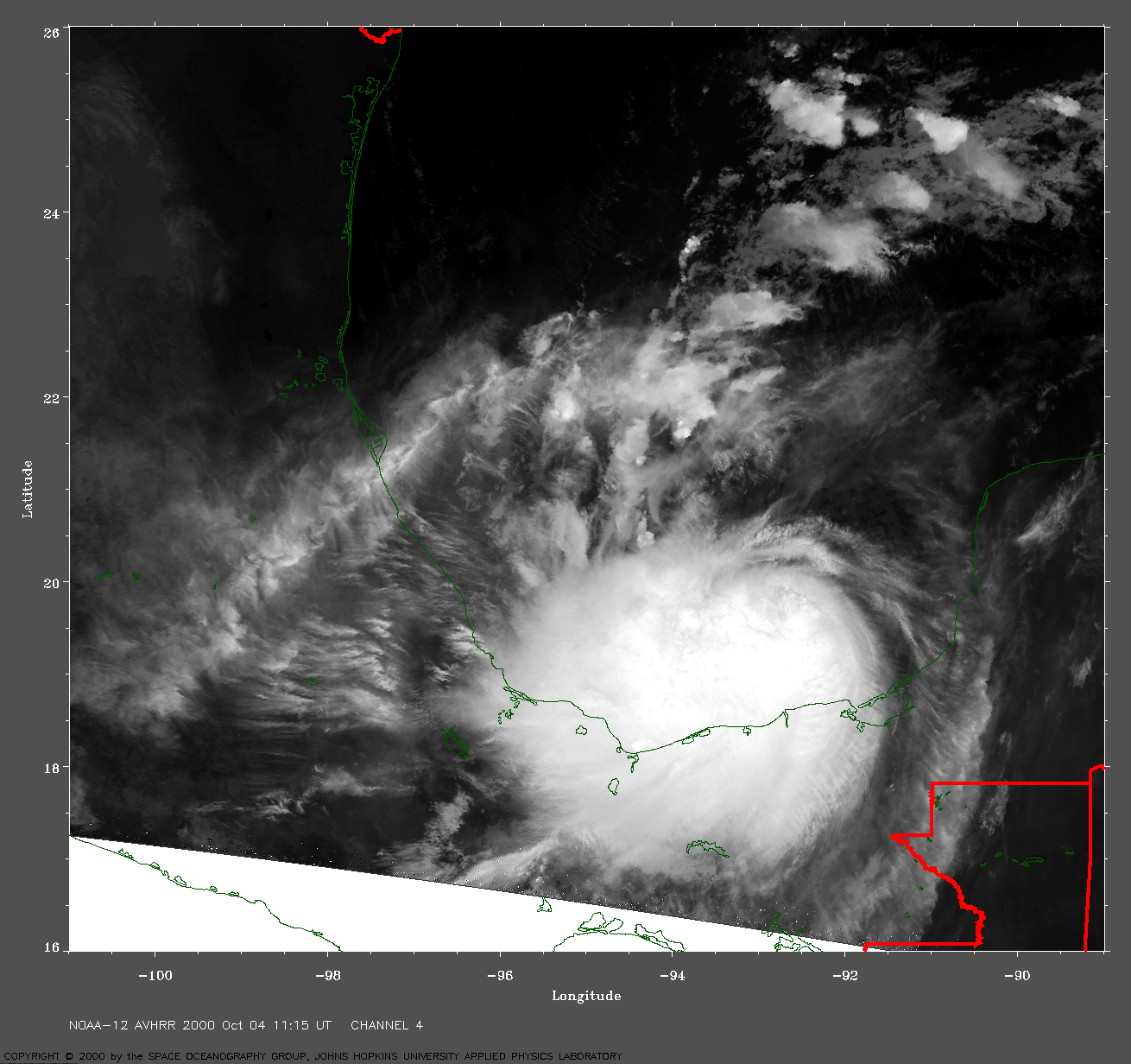
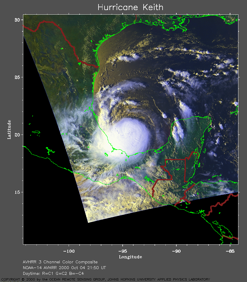 2000 October 04 21:50 UT
NOAA-14 satellite AVHRR 3 channel color composite afternoon image.
A closer view (332 Kb) is seen by clicking on this small image.
The maximum sustained winds have increased to 50 mph.
A very large image (785
Kb) is also available.
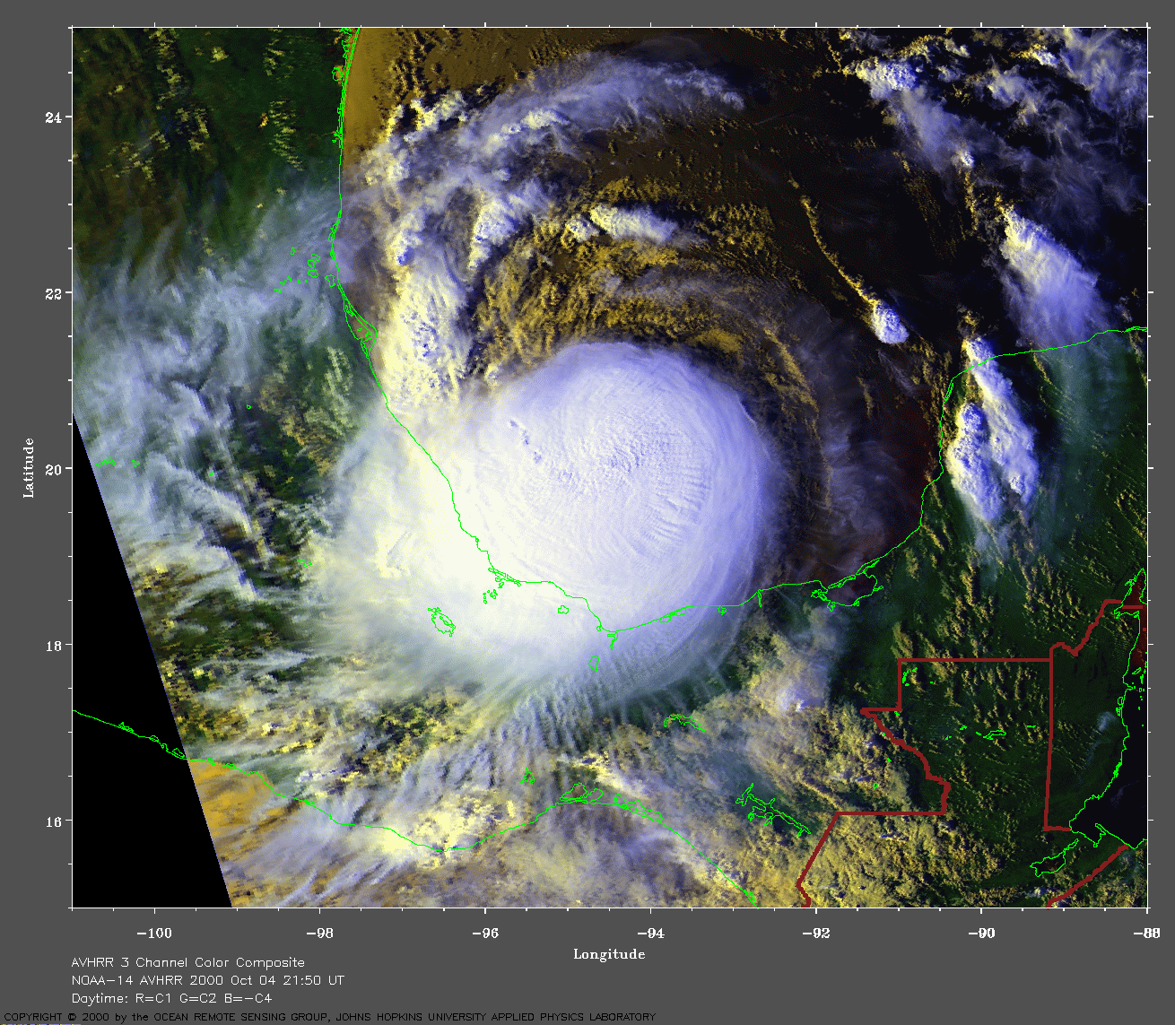
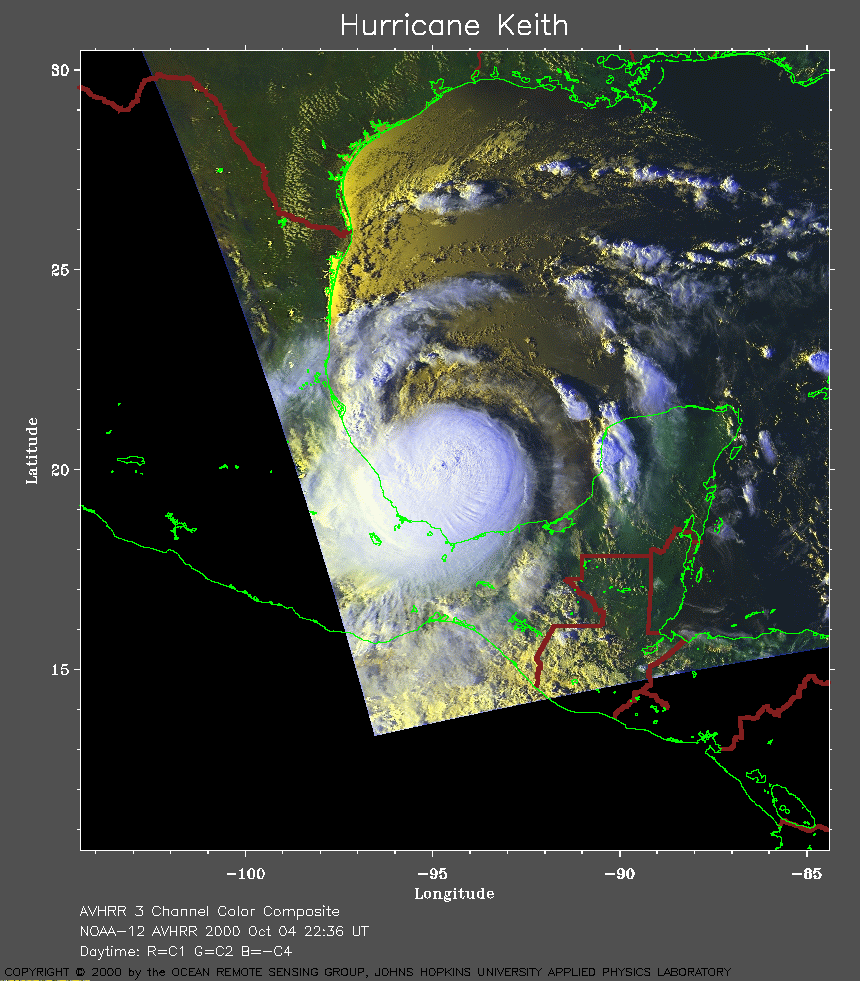 2000 October 04 22:36 UT
NOAA-12 satellite AVHRR 3 channel color composite afternoon image.
A closer view (276 Kb) is seen by clicking on this small image.
A very large image (903
Kb) is also available.
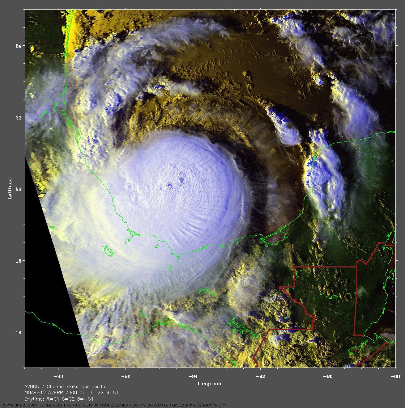
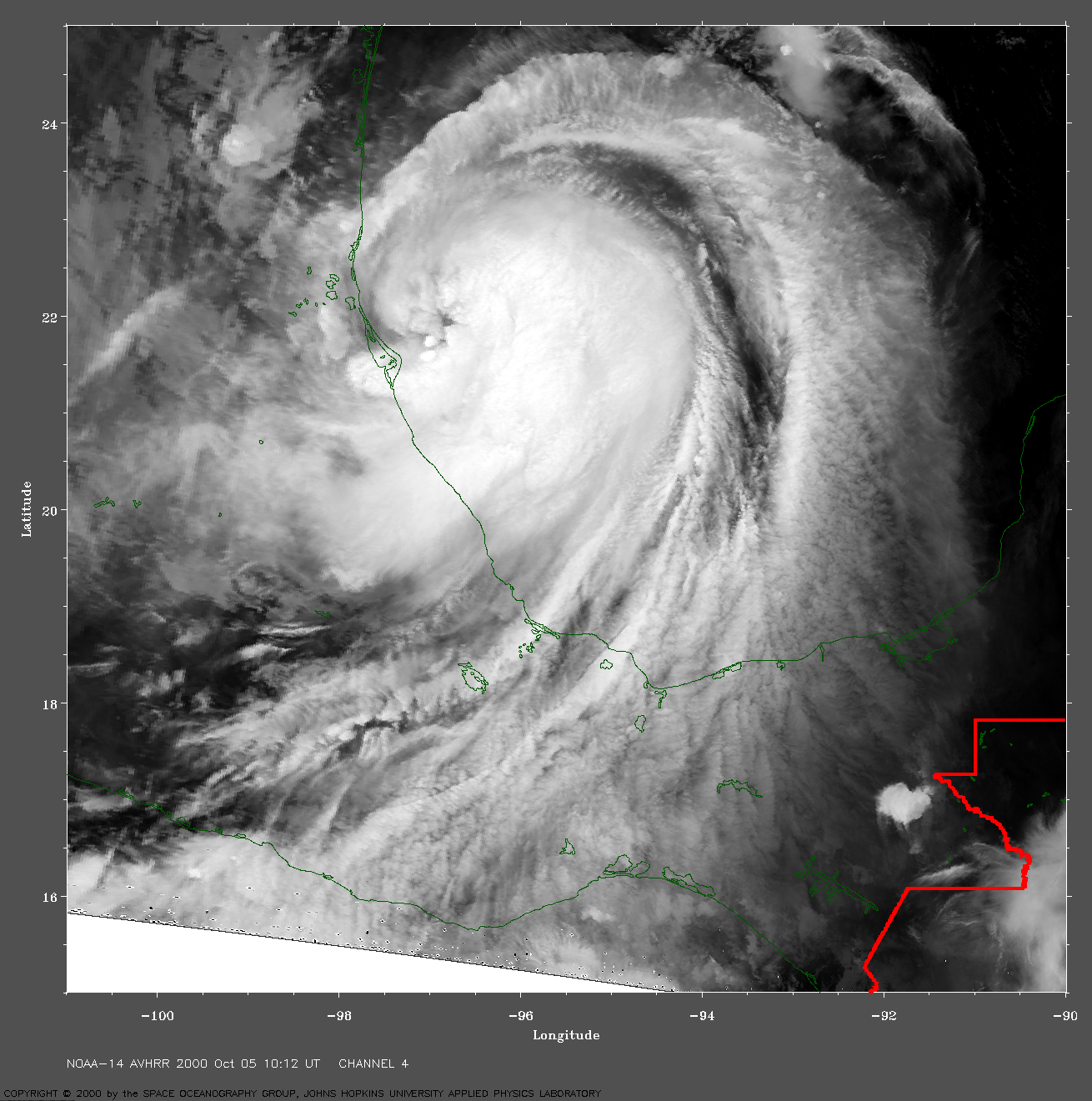
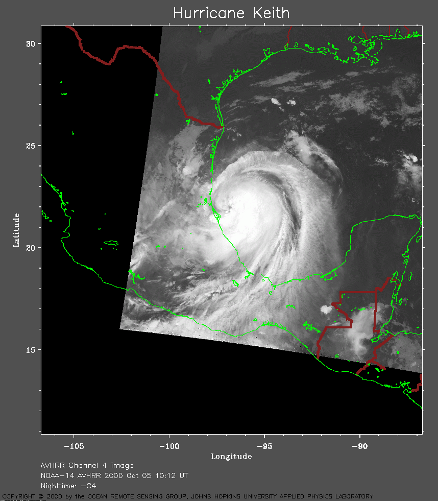 2000 October 05 10:12 UT
NOAA-14 satellite AVHRR channel 4 early morning image.
A closer view (190 Kb) is seen by clicking on this small image.
Because the maximum sustained winds have now increased to 75 mph, Keith
is a hurricane again.
A very large image (1022
Kb) is also available.
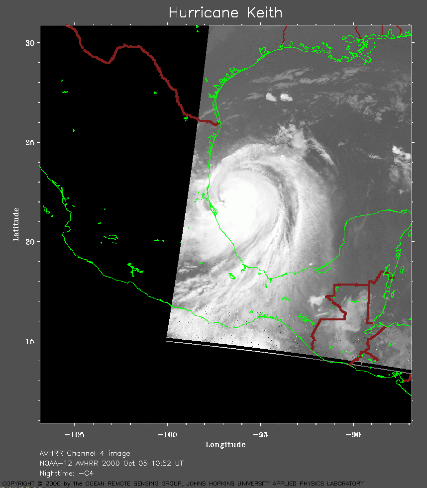 2000 October 05 10:52 UT
NOAA-12 satellite AVHRR channel 4 early morning image.
A closer view (153 Kb) is seen by clicking on this small image.
A very large image (767
Kb) is also available.
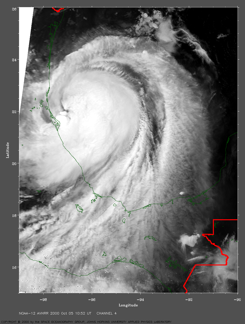
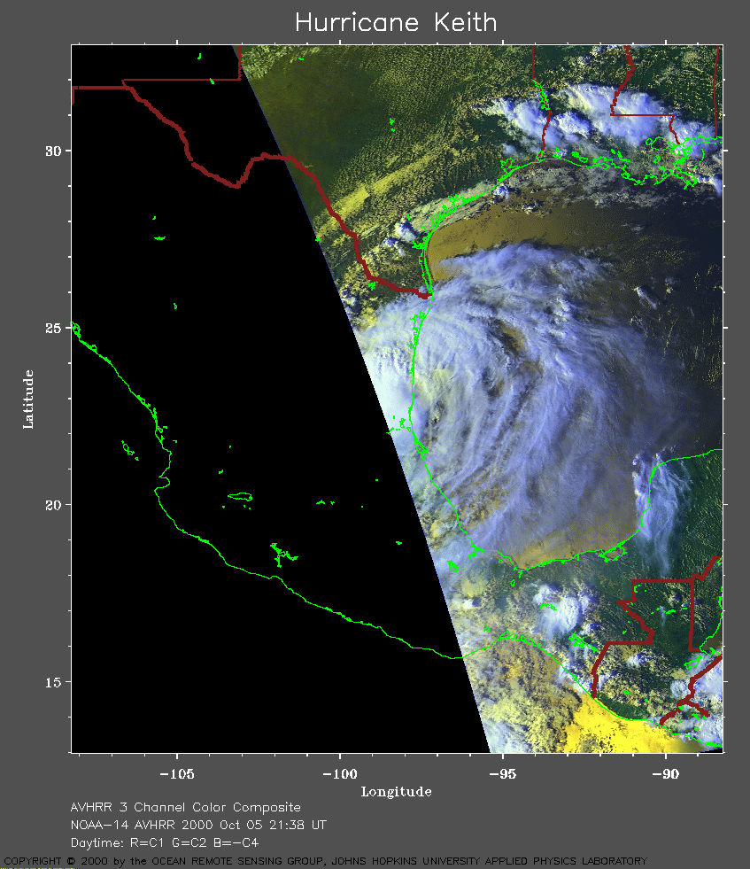 2000 October 05 21:38 UT
NOAA-14 satellite AVHRR 3 channel color composite evening image.
A closer view (263 Kb) is seen by clicking on this small image.
Keith made landfall just north of Tampico, Mexico, at about 18:00 UT.
At that time, the maximum sustained winds were 90 mph. By 21:00 UT,
these winds had decreased to 75 mph.
A very large image (702
Kb) is also available. The red line near the top left of this image
is the border between Texas and Mexico.