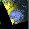
 2001 September 22 20:31 UT
NOAA-14 satellite AVHRR 3 channel color composite afternoon image.
A closer view (231 Kb) is seen by clicking on this small image.
The maximum sustained winds are 60 mph at 21:00 UT. The small J-shaped
island just north of the storm is Bermuda.
A very large image
(738 Kb) is also available.
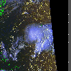 2001 September 22 21:36 UT
NOAA-12 satellite AVHRR 3 channel color composite evening image.
A closer view (324 Kb) is seen by clicking on this small image.
A very large image
(660 Kb) is also available.
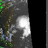 2001 September 22 22:09 UT
NOAA-14 satellite AVHRR 3 channel color composite evening image.
A closer view (229 Kb) is seen by clicking on this small image.
A very large Channel 4 image
(416 Kb) is also available.
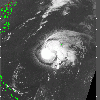 2001 September 23 09:53 UT
NOAA-12 satellite AVHRR channel 4 early morning image.
A closer view (250 Kb) is seen by clicking on this small image.
The maximum sustained winds are 65 mph at 09:00 UT. The small J-shaped
island just northeast of the storm center is Bermuda.
A very large image
(1031 Kb) is also available.
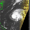 2001 September 23 10:32 UT
NOAA-14 satellite AVHRR channel 4 early morning image.
A closer view (242 Kb) is seen by clicking on this small image.
A very large image
(1031 Kb) is also available.
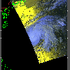 2001 September 23 20:20 UT
NOAA-14 satellite AVHRR 3 channel color composite afternoon image.
A closer view (211 Kb) is seen by clicking on this small image.
Humberto is now a hurricane with maximum sustained winds of 80 mph at
21:00 UT.
A very large image
(731 Kb) is also available.
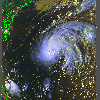 2001 September 23 21:13 UT
NOAA-12 satellite AVHRR 3 channel color composite evening image.
A closer view (401 Kb) is seen by clicking on this small image.
A very large image
(927 Kb) is also available.
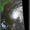 2001 September 23 21:57 UT
NOAA-14 satellite AVHRR 3 channel color composite evening image.
A closer view (270 Kb) is seen by clicking on this small image.
A very large Channel 4 image
(677 Kb) is also available.
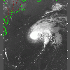 2001 September 24 09:30 UT
NOAA-12 satellite AVHRR channel 4 early morning image.
A closer view (230 Kb) is seen by clicking on this small image.
After increasing to 100 mph at 03:00 UT, the maximum sustained winds decreased to 90 mph at
09:00 UT.
A very large image
(953 Kb) is also available.
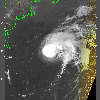 2001 September 24 10:20 UT
NOAA-14 satellite AVHRR channel 4 morning image.
A closer view (227 Kb) is seen by clicking on this small image.
A very large image
(794 Kb) is also available.
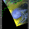 2001 September 24 20:09 UT
NOAA-14 satellite AVHRR 3 channel color composite afternoon image.
A closer view (218 Kb) is seen by clicking on this small image.
The maximum sustained winds decreased to 85 mph at 15:00 UT.
A very large image
(639 Kb) is also available.
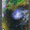 2001 September 24 20:50 UT
NOAA-12 satellite AVHRR 3 channel color composite afternoon image.
A closer view (380 Kb) is seen by clicking on this small image.
A very large image
(821 Kb) is also available.
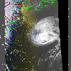 2001 September 24 21:45 UT
NOAA-14 satellite AVHRR 3 channel color composite evening image.
A closer view (302 Kb) is seen by clicking on this small image.
The maximum sustained winds decreased to 80 mph at 21:00 UT.
A very large Channel 4 image
(637 Kb) is also available.
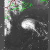 2001 September 25 09:07 UT
NOAA-12 satellite AVHRR channel 4 early morning image.
A closer view (237 Kb) is seen by clicking on this small image.
The maximum sustained winds decreased to 75 mph at 03:00 UT.
A very large image
(765 Kb) is also available.
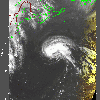 2001 September 25 10:08 UT
NOAA-14 satellite AVHRR channel 4 morning image.
A closer view (245 Kb) is seen by clicking on this small image.
A very large image
(801 Kb) is also available.
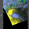 2001 September 25 19:58 UT
NOAA-14 satellite AVHRR 3 channel color composite afternoon image.
A closer view (240 Kb) is seen by clicking on this small image.
A very large image
(601 Kb) is also available.
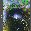 2001 September 25 20:28 UT
NOAA-12 satellite AVHRR 3 channel color composite afternoon image.
A closer view (350 Kb) is seen by clicking on this small image.
A very large image
(484 Kb) is also available.
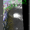 2001 September 25 21:33 UT
NOAA-14 satellite AVHRR 3 channel color composite evening image.
A closer view (251 Kb) is seen by clicking on this small image.
A very large image
(406 Kb) is also available.
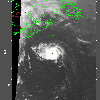 2001 September 26 08:44 UT
NOAA-12 satellite AVHRR channel 4 early morning image.
A closer view (203 Kb) is seen by clicking on this small image.
The maximum sustained winds increased to 80 mph at 09:00 UT.
A very large image
(505 Kb) is also available.
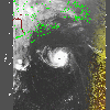 2001 September 26 09:56 UT
NOAA-14 satellite AVHRR channel 4 early morning image.
A closer view (223 Kb) is seen by clicking on this small image.
A very large image
(659 Kb) is also available.
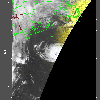 2001 September 26 10:23 UT
NOAA-12 satellite AVHRR channel 4 early morning image.
A closer view (163 Kb) is seen by clicking on this small image.
A very large image
(438 Kb) is also available.
 2001 September 26 20:06 UT
NOAA-12 satellite AVHRR 3 channel color composite afternoon image.
A closer view (354 Kb) is seen by clicking on this small image.
The maximum sustained winds increased to 105 mph at 15:00 UT.
 2001 September 26 21:21 UT
NOAA-14 satellite AVHRR 3 channel color composite evening image.
A closer view (214 Kb) is seen by clicking on this small image.
The maximum sustained winds decreased to 90 mph at 21:00 UT.
 2001 September 26 19:45 UT
NOAA-12 satellite AVHRR 3 channel color composite afternoon image.
A closer view (292 Kb) is seen by clicking on this small image.
The maximum sustained winds decreased to 50 mph at 21:00 UT as Humberto
loses its tropical characteristics.
A very large image
(660 Kb) is also available.