Track file
Track data in a text file.
 1996
Nov 19 07:43 UT
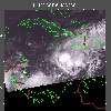
NOAA-14 AVHRR Channel 4 nighttime image. This image shows Marco in
its early stages. It is near the edge of the receiving range of the APL
ground station. Therefore,
there are regions of data loss near the bottom of this image. This is
the cause of the black pixels near the edge of the scan. There is NO
eye in this image.
It is instead a two pixel data dropout that happens to be located in the
center of the circulation. Click on the small image for a large (84
Kb) view. A very large image (186 Kb)
is also available.
 1996
Nov 20 23:30 UT
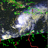
NOAA-12 AVHRR Channel 4 nighttime image. This image shows Tropical
Storm Marco recently downgraded from Hurricane status. Marco is weakening
due to strong upper level southwesterly winds shearing the convective
clouds to the east of the center of the circulation. However, later
during the night of November 20, deep convection redeveloped and the
westerlies weakened somewhat, allowing Marco to maintain Tropical Storm
strength. Click on the small image for a large (101 Kb) view. A very large image (230 Kb)
is also available.
 1996
Nov 21 18:47 UT
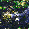
NOAA-14 AVHRR 3 channel composite daytime image. The cooler clouds
are white and the warmer clouds are yellow. This image shows a
weakened Tropical Storm Marco with 45 mph maximum sustained winds. Marco
is nearly stationary. Click on the small image for a large (140
Kb) view. A very large image (335 Kb)
is also available.
 1996
Nov 23 18:25 UT
NOAA-14 AVHRR 3 channel composite daytime image. The cooler clouds
are white and the warmer clouds are yellow. This image shows Marco
weakened to a Tropical Depression with 35 mph maximum sustained winds.
Note how the higher clouds are being sheared off exposing the lower
(yellow) clouds. Marco is moving west. Despite forecasts of its
imminent demise, it will re-strengthen to Tropical Storm status and
65 mph winds. Click on the small image for a large (398 Kb) view. A very large image (894 Kb)
is provided. A CLOSE-UP view of Marco in both large (387 Kb)
and
very large (832 Kb)
formats is also provided.
 1996
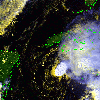
Nov 25 19:45 UT
NOAA-14 AVHRR 3 channel composite daytime image. The cooler clouds
are white and the warmer clouds are yellow. Marco has re-strengthened
again and now has 50 mph maximum sustained winds. Marco is moving
toward the northwest. Notice the clouds associated with a cold front
moving across the Gulf of Mexico from the northwest. This is expected
to increase the shear and weaken Marco further. It is possible that
Marco may merge with this cold front. Click on the small image for a
large (383 Kb) view. A very large image (852 Kb)
is also provided.
 1996
Nov 26 19:35 UT
NOAA-14 AVHRR 3 channel composite daytime image. The cooler clouds
are white and the warmer clouds are yellow. Marco has weakened considerably
and now has 30 mph maximum sustained winds. Notice the upper (cooler)
clouds are sheared
off toward the northeast, exposing the remains of the circulation of
the lower (warmer)
clouds. A cold front is represented by the narrow band of yellow clouds
stretching from northeast across Cuba to southwest (towards Yucatan).
Marco appears to be merging with this cold front.
Click on the small image for a large (467 Kb) view. A very large image (1035 Kb)
is also provided.
