Track file
Track data in a text file.
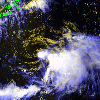 1997 July 1 18:34 UT
NOAA-14 AVHRR 3 channel composite daytime image. The
cooler clouds are white and the warmer clouds are yellow.
A closer view (327 Kb) of TS Ana from 18:34 UT July 1 is seen by
clicking on this small image.
TS Ana is a weak tropical storm with 45 mph maximum sustained winds.
Considerable wind shear on the east flank of the storm is exposing the
center.
A very large image
(713 Kb) is also available.
For reference,
here is a regional view (176 Kb) of the Southeast US at 1997 July 1
18:34 UT showing TS Ana off the South Carolina coast.
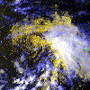 1997 July 2 18:23 UT
NOAA-14 AVHRR 3 channel composite daytime image.
A closer view (340 Kb) of TS Ana from 18:23 UT July 2 is seen by
clicking on this small image. The National Weather
Service reports that TS Ana is shallow and lacking deep convection, but
that the low level circulation is spinning rapidly. The maximum
sustained winds have dropped to 40 mph.
A very large image
(767 Kb) is also available.
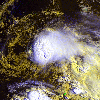 1997 July 3 11:44 UT
NOAA-12 AVHRR 3 channel composite daytime image.
A closer view (316 Kb) of TS Ana from 11:44 UT July 3 is seen by
clicking on this small image. TS Ana is slowly weakening due to
the upper level wind shear on the western side. Small low level (yellow)
cloud vortices can be seen rotating around the center of TS Ana.
A very large image
(697 Kb) is also available.
 1997 July 3 18:13 UT
NOAA-14 AVHRR 3 channel composite daytime image.
A closer view (295 Kb) of TS Ana from 18:23 UT July 2 is seen by
clicking on this small image. The National Weather Service reports
that Ana has weakened to a tropical depression with 35 mph maximum
sustained winds. The high level (white) clouds have been saturated
during processing in order to enhance the low level (yellow) clouds.
Small low level vortices can still be seen. The storm is now over
cooler water that will hasten its demise. Notice the sun glitter
pattern on the sea surface near latitude 36N, longitude 71-72W, off
the Delmarva Peninsula.
A very large image
(648 Kb) is also available.
