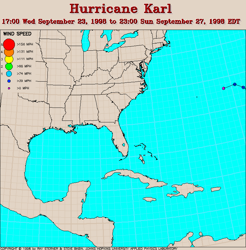
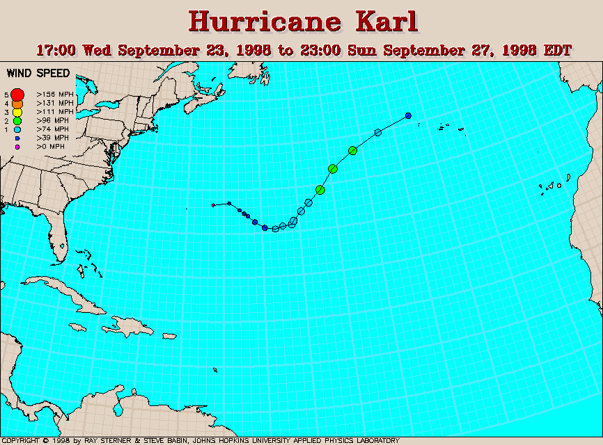
Track maps
Track file
Track data (lat/lon, winds, etc.) in a text file.
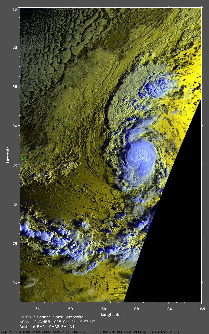
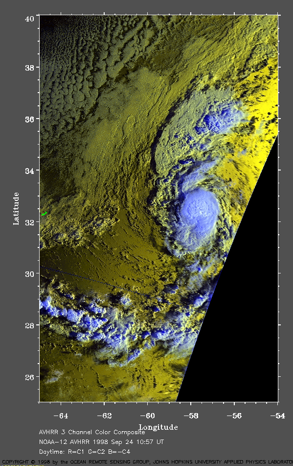 1998 September 24 10:57 UT
NOAA-12 AVHRR 3 channel color
composite morning image. A closer view (295 Kb) is seen by clicking
on this small image. At this time, Karl has 40 mph winds and is
moving toward the northeast away from Bermuda (outlined in green on the
left edge of the image). Note the lower warmer clouds are yellow and
the higher cooler clouds are white. Because this is an early morning
image, there is significant sun glint to the northeast of Karl.
A very large image (634 Kb)
is also available.
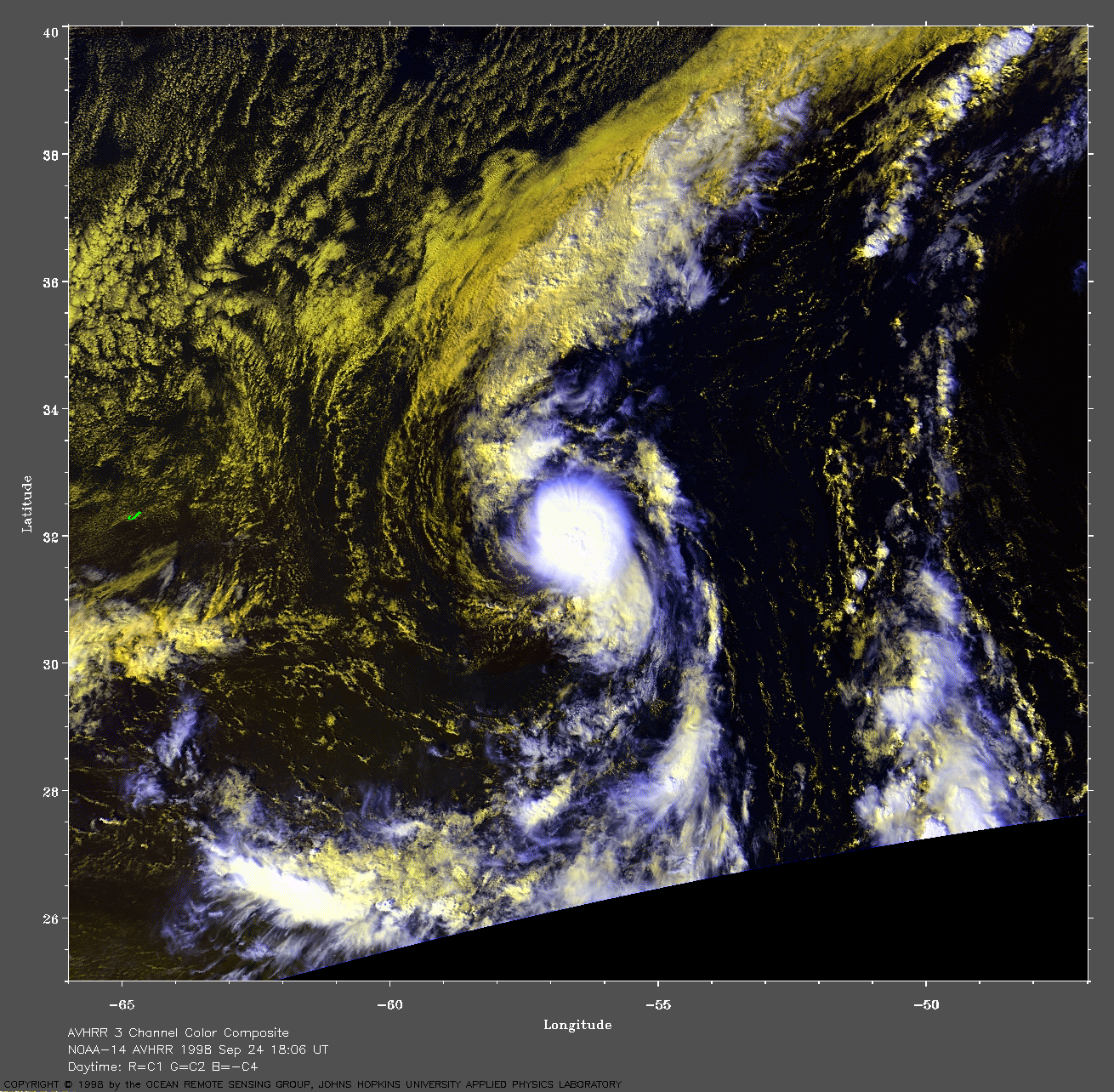
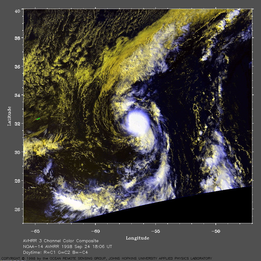 1998 September 24 18:06 UT
NOAA-14 AVHRR 3 channel color
composite daytime image. A closer view (310 Kb) is seen by clicking
on this small image. The maximum sustained winds have now increased to
about 45 mph and Karl is moving toward the east-southeast.
A very large image (614 Kb)
is also available.
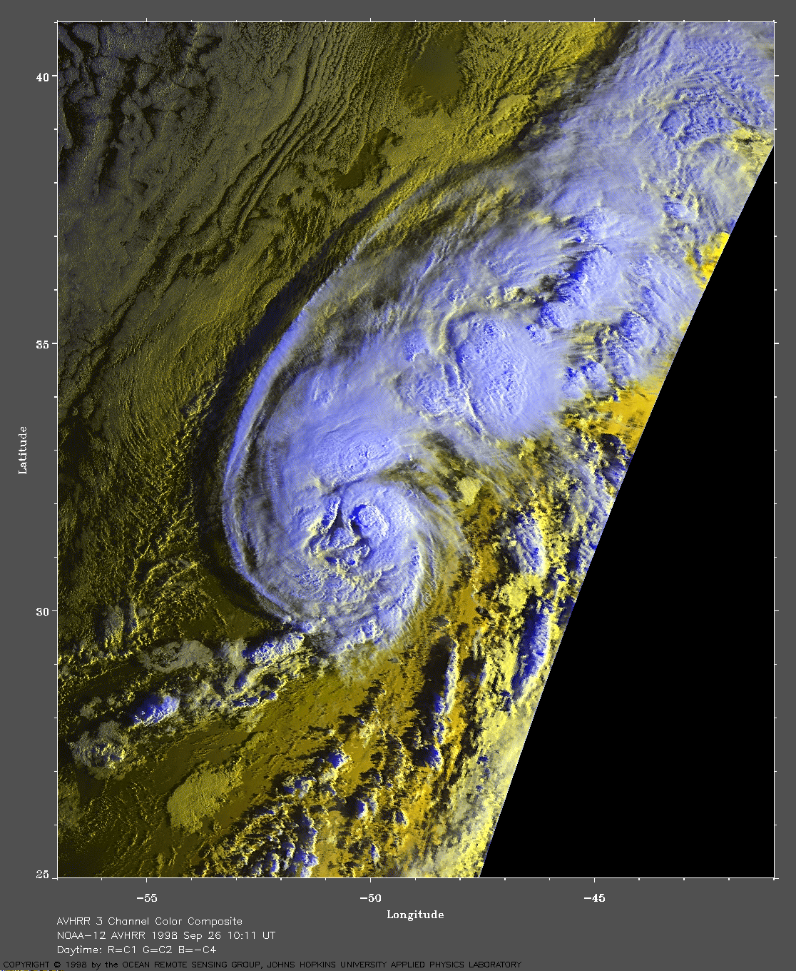
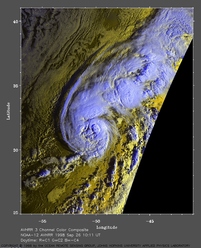 1998 September 26 10:11 UT
NOAA-12 AVHRR 3 channel color
composite morning image. A closer view (380 Kb) is seen by clicking
on this small image. At this time, the maximum sustained winds in
Karl have increased to 85 mph. Karl is now moving to the northeast.
There is some hint of an eye formation in this image.
Because this is an early morning
image, there is significant sun glint to the northeast of Karl.
A very large image (824 Kb)
is also available.
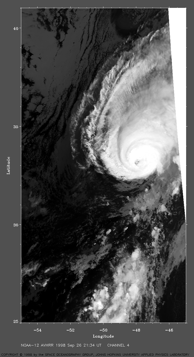
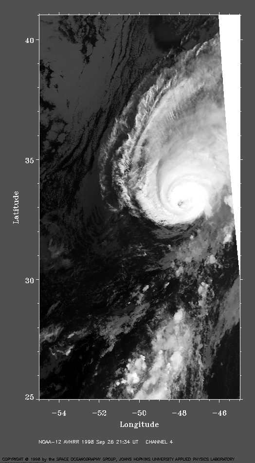 1998 September 26 21:34 UT
NOAA-12 AVHRR channel 4 nighttime
image. A closer view (294 Kb) is seen by clicking on this small image.
The eye is now plainly visible in this image.
Karl is moving toward the northeast and will eventually strengthen to
105 mph winds.
A very large image (560 Kb)
is also available.