 1999 August 26 07:37 UT
NOAA-14
AVHRR channel 4 early morning image. A closer view (322 Kb)
is seen by clicking on this small image.
A very large image ( Kb)
is also available.
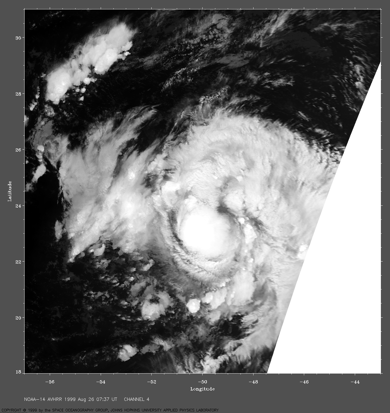
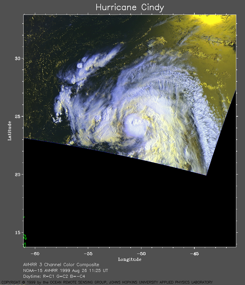 1999 August 26 11:25 UT
NOAA-15
AVHRR 3 channel color composite daytime image. A closer view (271 Kb)
is seen by clicking on this small image.
A very large image (704 Kb)
is also available.
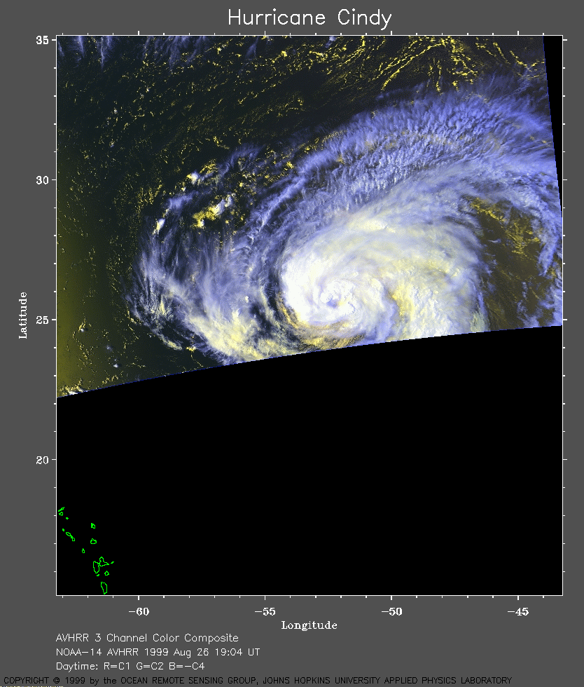 1999 August 26 19:04 UT
NOAA-14
AVHRR 3 channel color composite daytime image. A closer view (244 Kb)
is seen by clicking on this small image.
A very large image (595 Kb)
is also available.
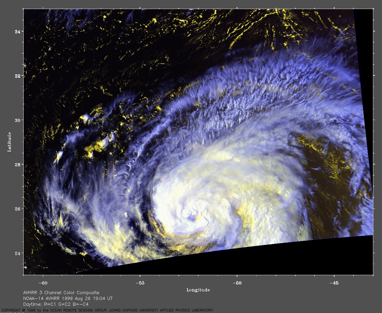
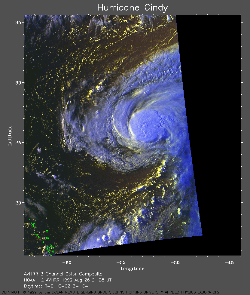 1999 August 26 21:28 UT
NOAA-12
AVHRR 3 channel color composite daytime image. A closer view (322 Kb)
is seen by clicking on this small image.
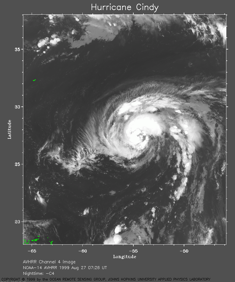 1999 August 27 07:26 UT
NOAA-14
AVHRR channel 4 early morning image. A closer view (286 Kb)
is seen by clicking on this small image.
A very large image (901 Kb)
is also available.
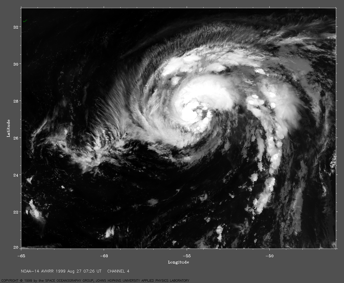
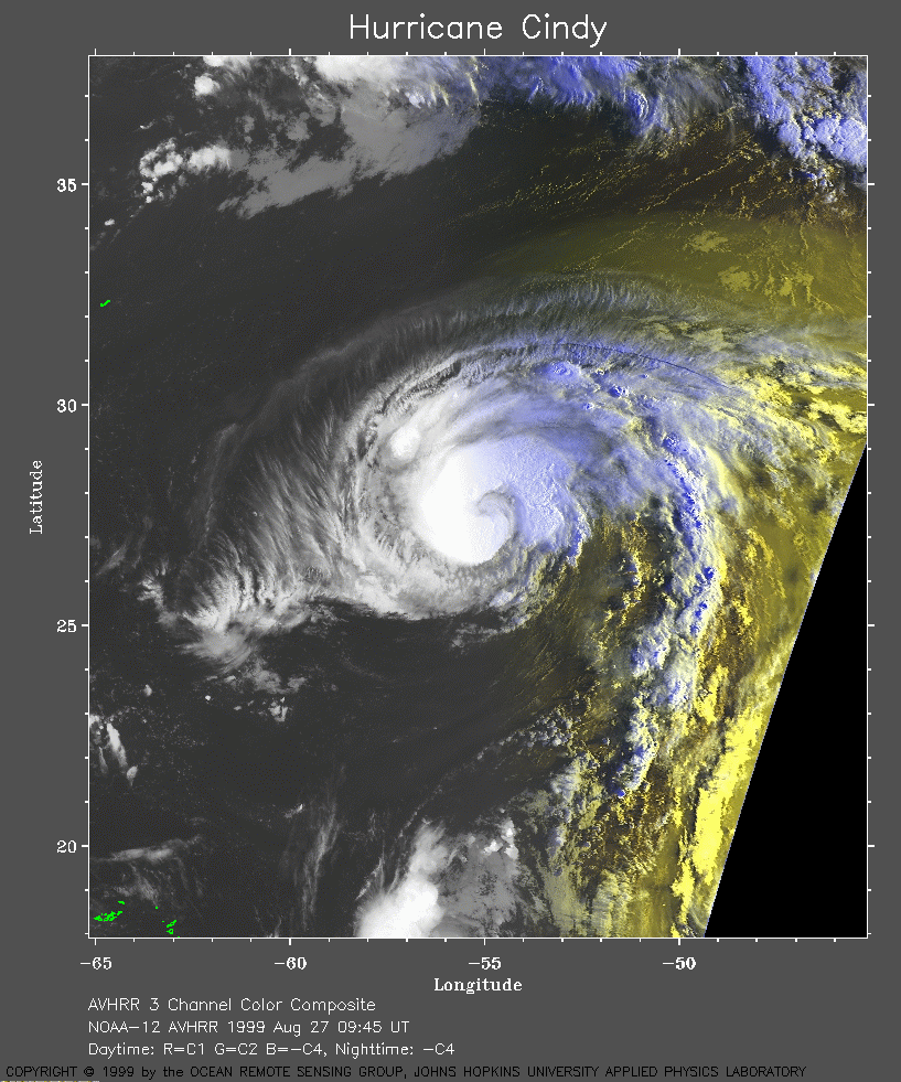 1999 August 27 09:45 UT
NOAA-12
AVHRR 3 channel color composite early morning image. A closer view (346 Kb)
is seen by clicking on this small image.
A very large image (667 Kb)
is also available.
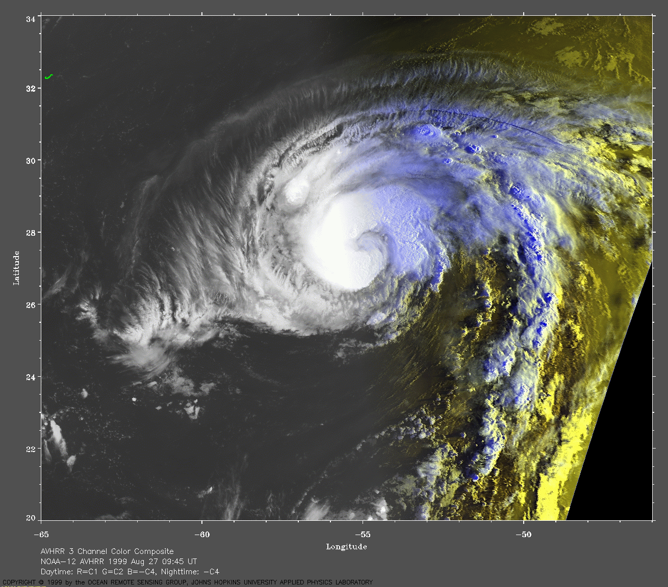
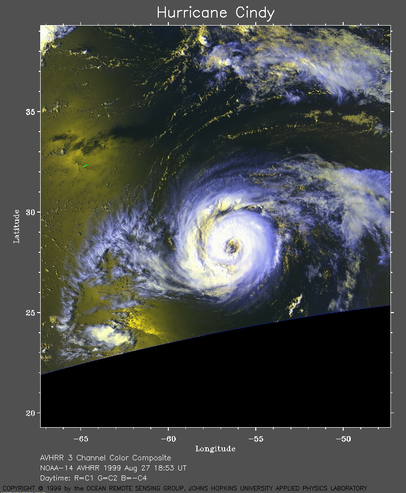 1999 August 27 18:53 UT
NOAA-14
AVHRR 3 channel color composite early morning image. A closer view (315 Kb)
is seen by clicking on this small image.
A very large image (494 Kb)
is also available.
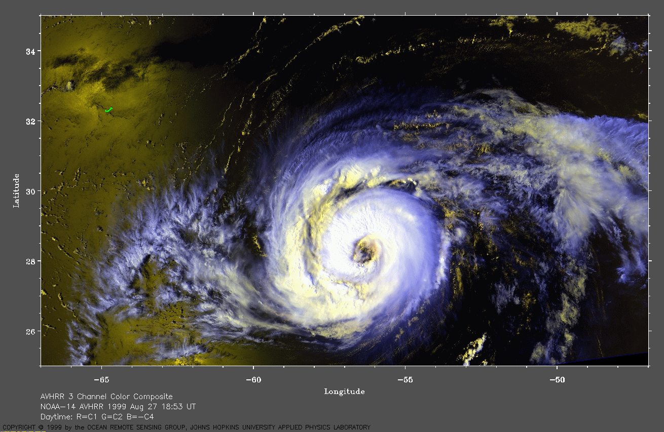
 1999 August 27 21:07 UT
NOAA-12
AVHRR 3 channel color composite daytime image. A closer view (324 Kb)
is seen by clicking on this small image.
A very large image (620 Kb)
is also available.
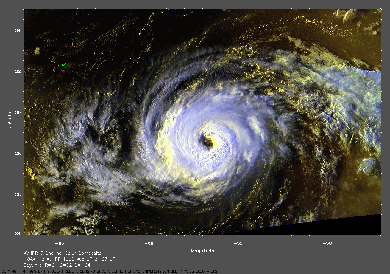
 1999 August 28 07:15 UT
NOAA-14
AVHRR channel 4 early morning image. A closer view (222 Kb)
is seen by clicking on this small image.
A very large image (746 Kb)
is also available.
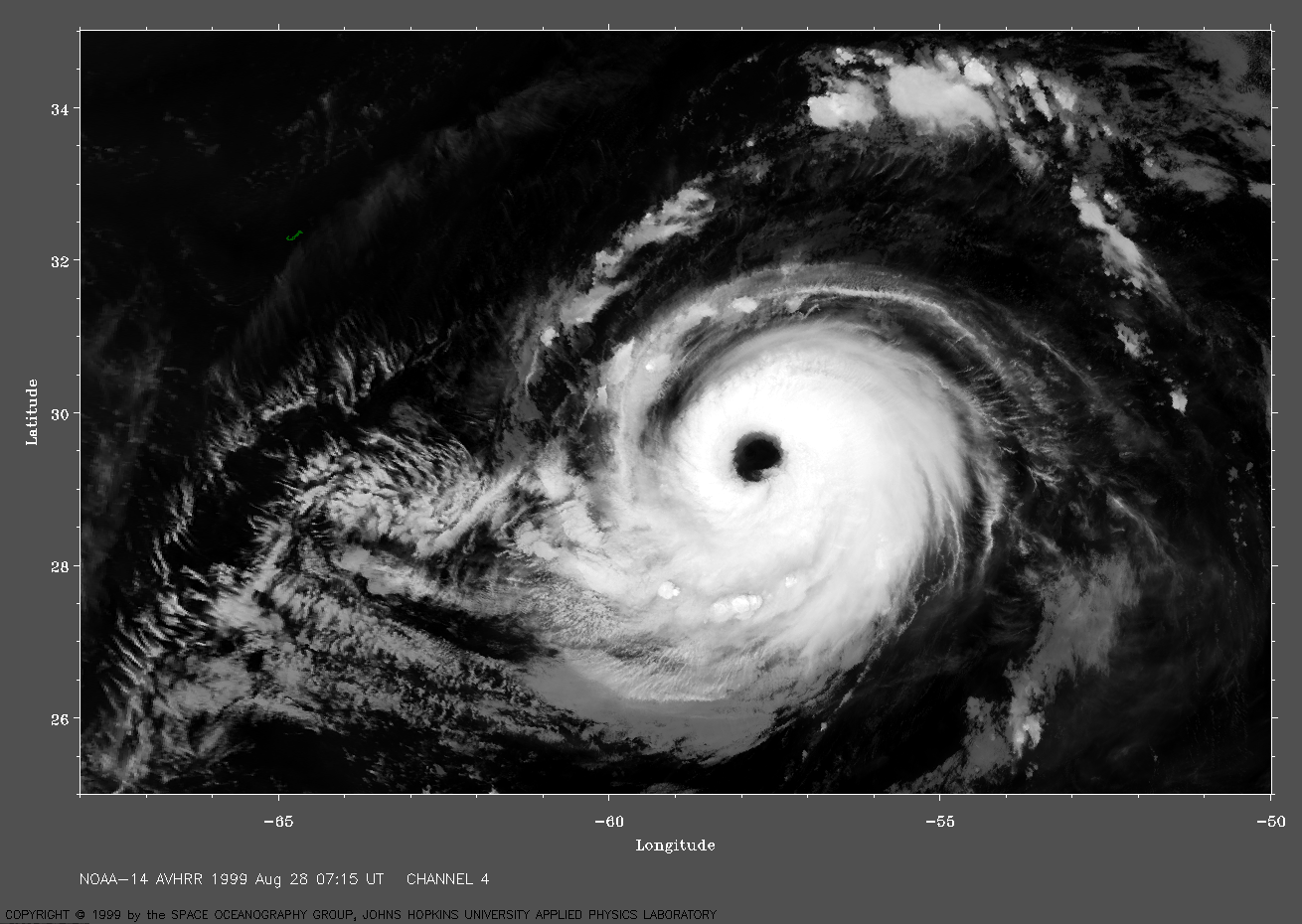
 1999 August 28 09:24 UT
NOAA-12
AVHRR channel 4 early morning image. A closer view (216 Kb)
is seen by clicking on this small image.
A very large image (829 Kb)
is also available.
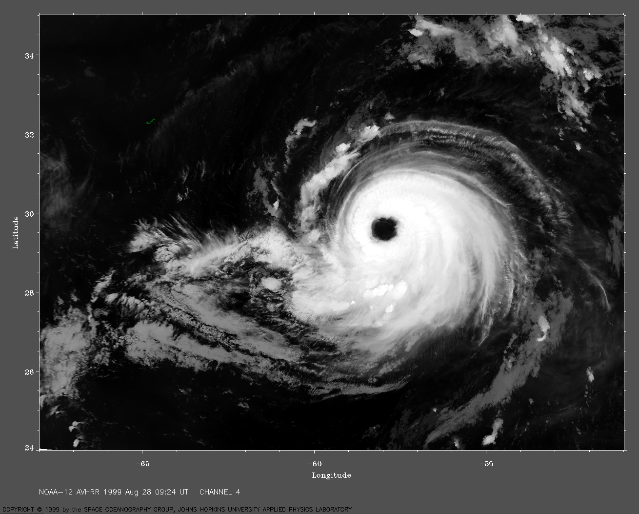
 1999 August 28 12:21 UT
NOAA-15
AVHRR 3 channel color composite daytime image. A closer view (296 Kb)
is seen by clicking on this small image.
A very large image (547 Kb)
is also available.
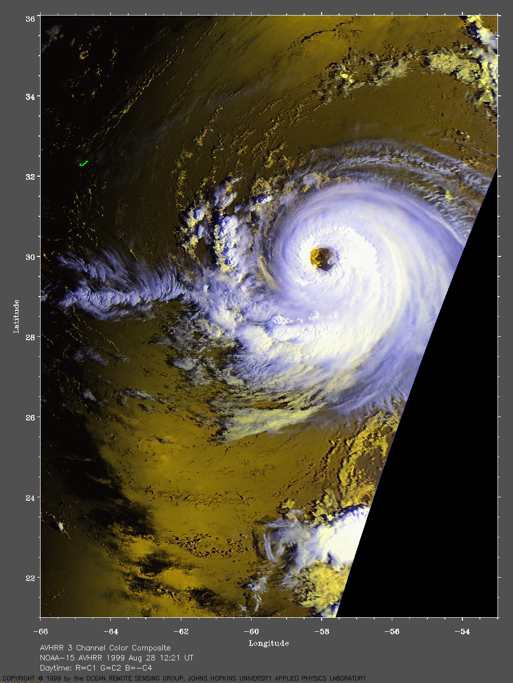
 1999 August 28 18:42 UT
NOAA-14
AVHRR 3 channel color composite daytime image. A closer view (291 Kb)
is seen by clicking on this small image. The maximum sustained winds
have increased to 140 mph, making Cindy a Category 4 hurricane on the
Saffir-Simpson Scale.
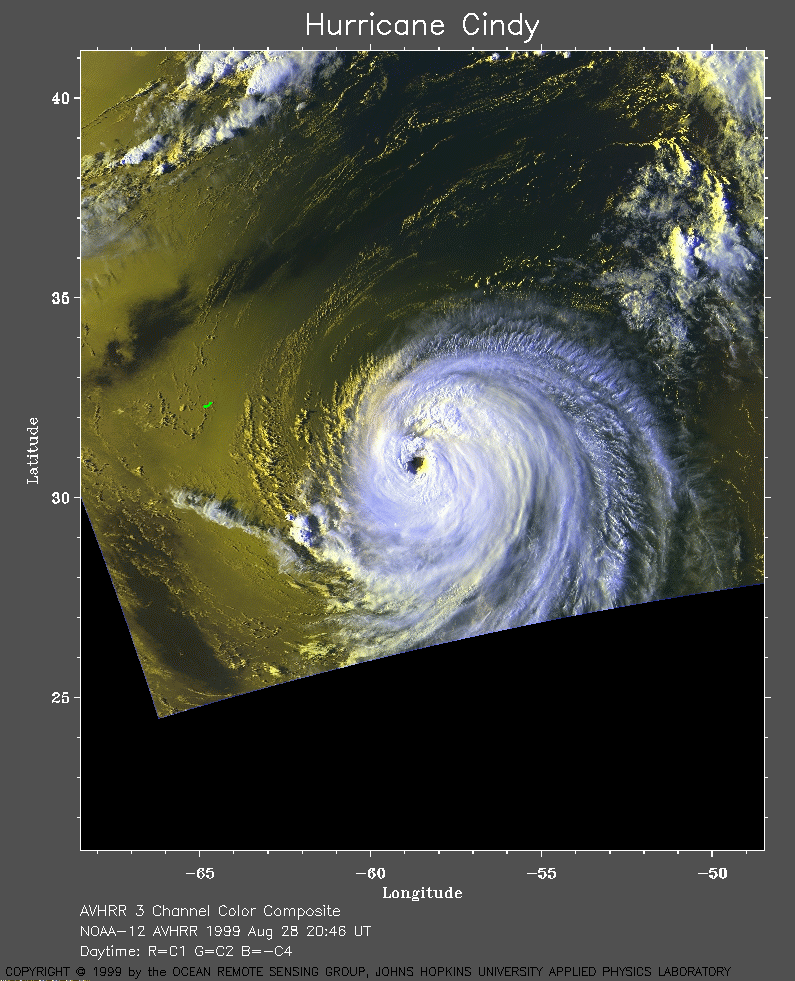 1999 August 28 20:46 UT
NOAA-12
AVHRR 3 channel color composite daytime image. A closer view (325 Kb)
is seen by clicking on this small image.
A very large image (729 Kb)
is also available (because our file became corrupted, this
image was created from raw data kindly provided by Rutgers U.).
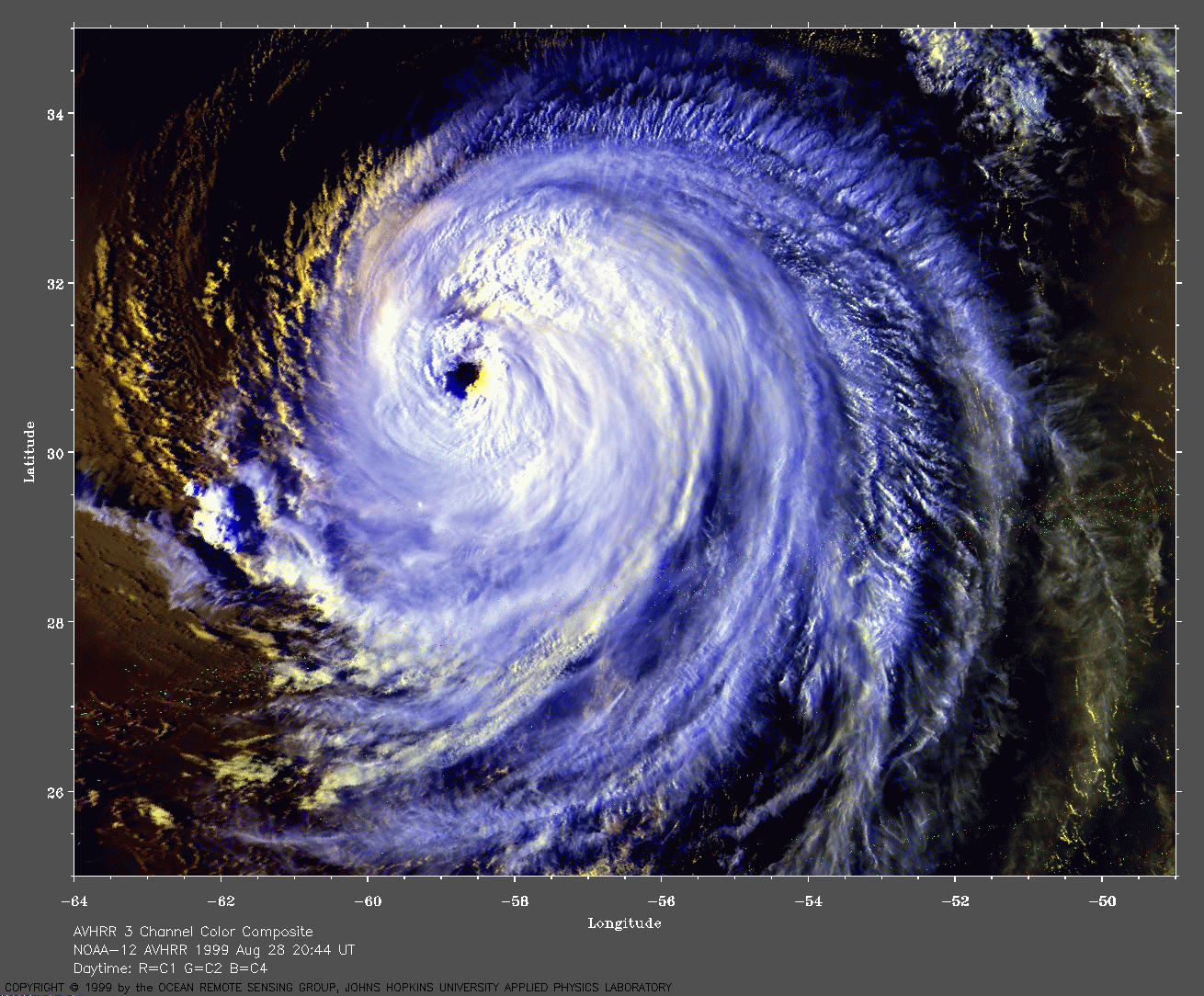
 1999 August 28 23:40 UT
NOAA-15
AVHRR channel 4 evening image. A closer view (202 Kb)
is seen by clicking on this small image.
A very large image (640 Kb)
is also available.
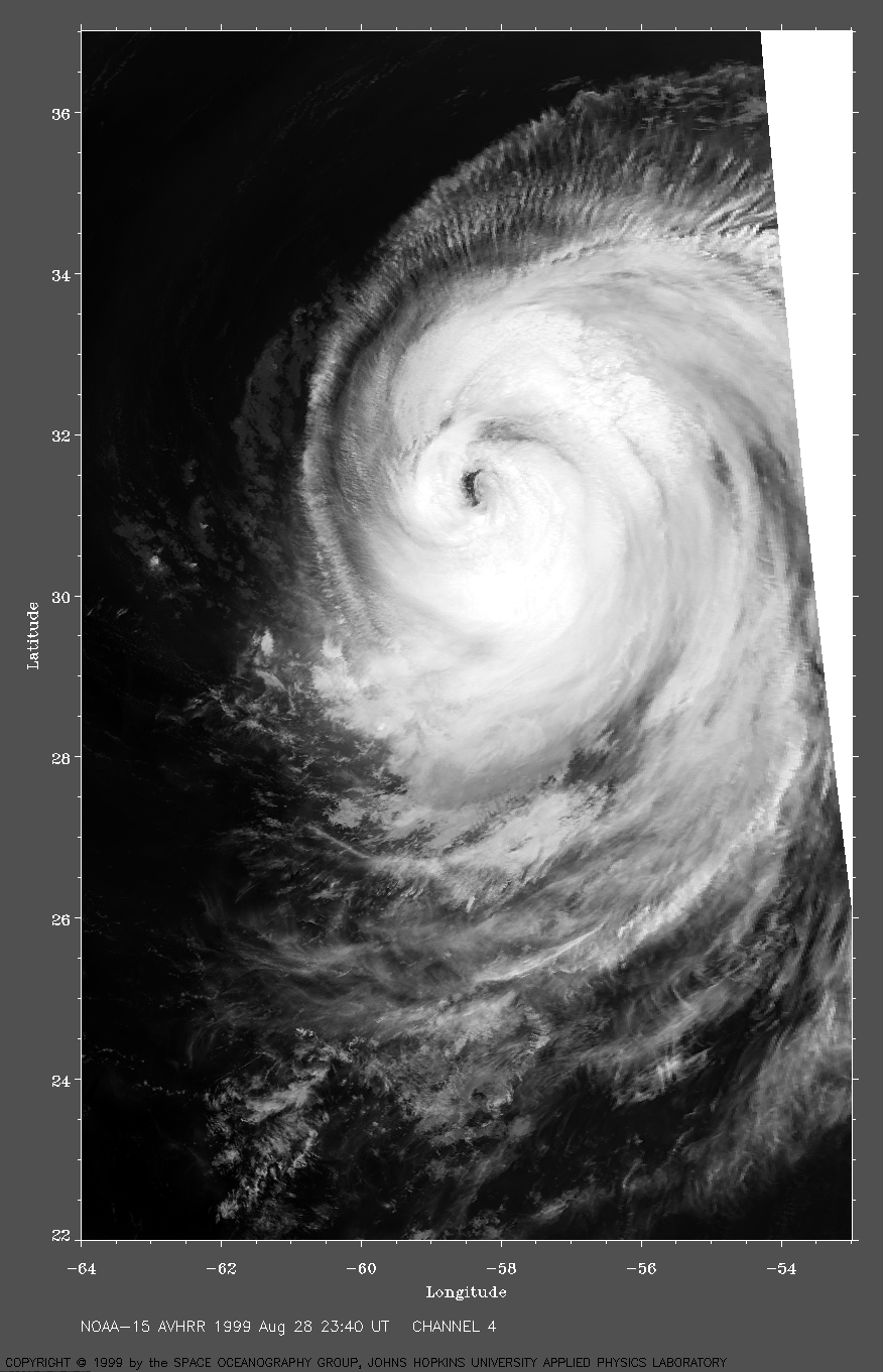
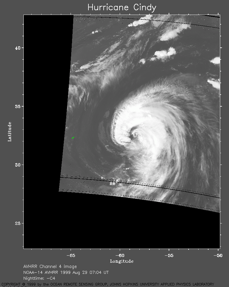 1999 August 29 07:04 UT
NOAA-14
AVHRR channel 4 early morning image. A closer view (178 Kb)
is seen by clicking on this small image.
A very large image (1029 Kb)
is also available.
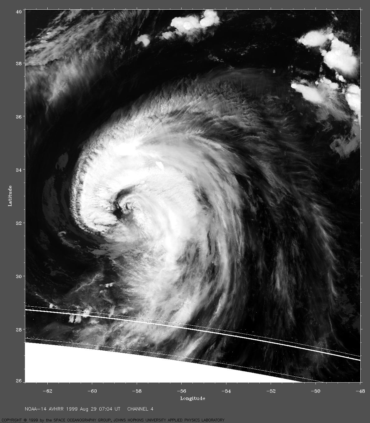
 1999 August 29 10:40 UT
NOAA-12
AVHRR 3 channel color composite daytime image. A closer view (290 Kb)
is seen by clicking on this small image. The maximum sustained winds
have now decreased from 140 to 125 mph.
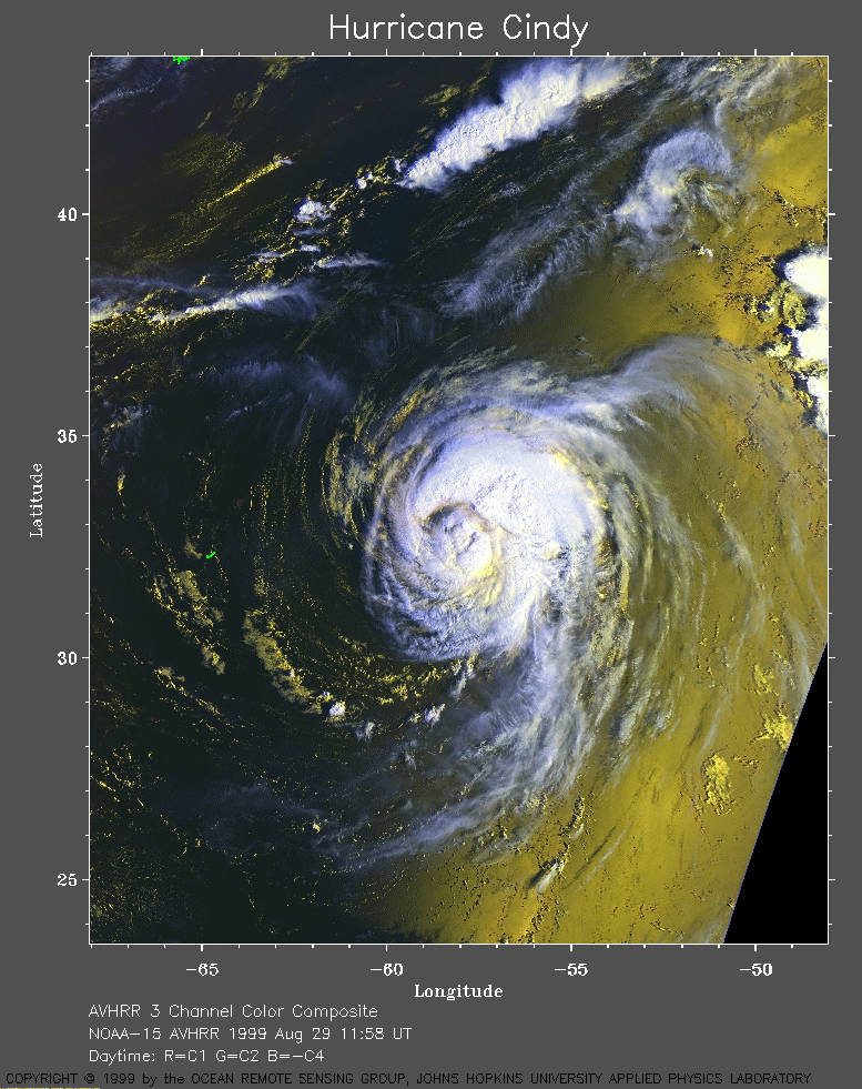 1999 August 29 11:58 UT
NOAA-15
AVHRR 3 channel color composite daytime image. A closer view (384 Kb)
is seen by clicking on this small image.
A very large image (809 Kb)
is also available.
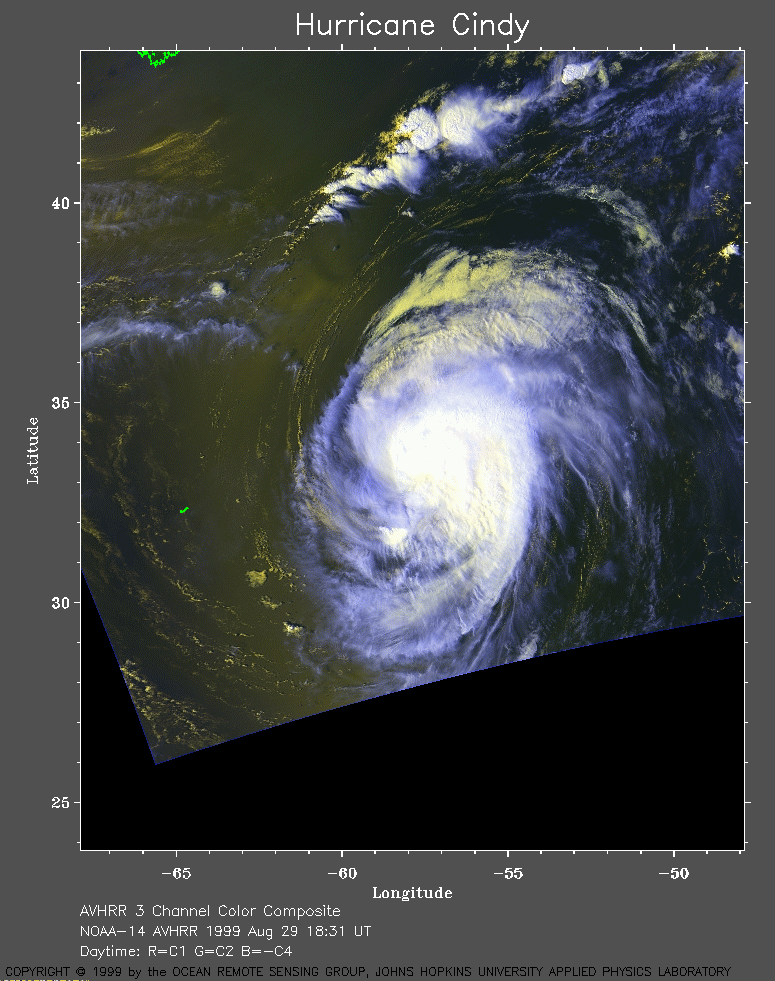 1999 August 29 18:31 UT
NOAA-14
AVHRR 3 channel color composite daytime image. A closer view (286 Kb)
is seen by clicking on this small image.
The maximum sustained winds have decreased from 125 to 110 mph.
A very large image (670 Kb)
is also available.
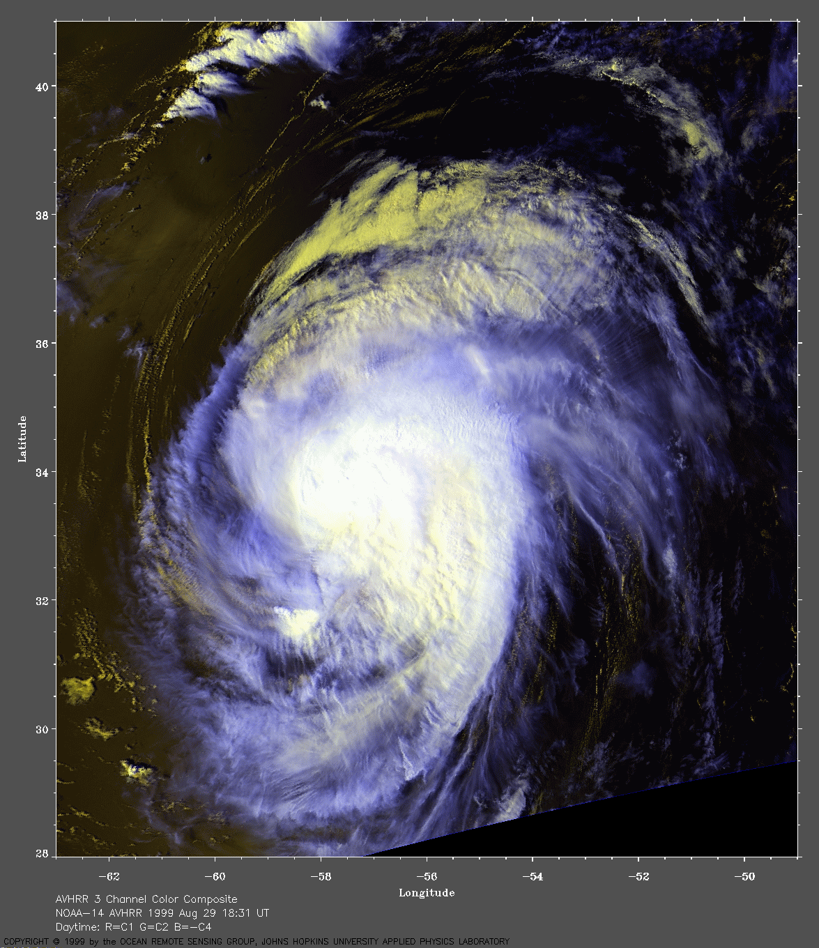
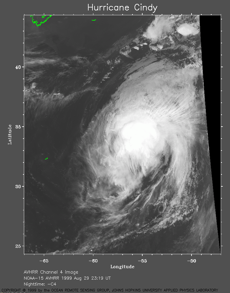 1999 August 29 23:19 UT
NOAA-15
AVHRR channel 4 evening image. A closer view (260 Kb)
is seen by clicking on this small image.
The maximum sustained winds have decreased from 110 to 105 mph.
A very large image (883 Kb)
is also available.
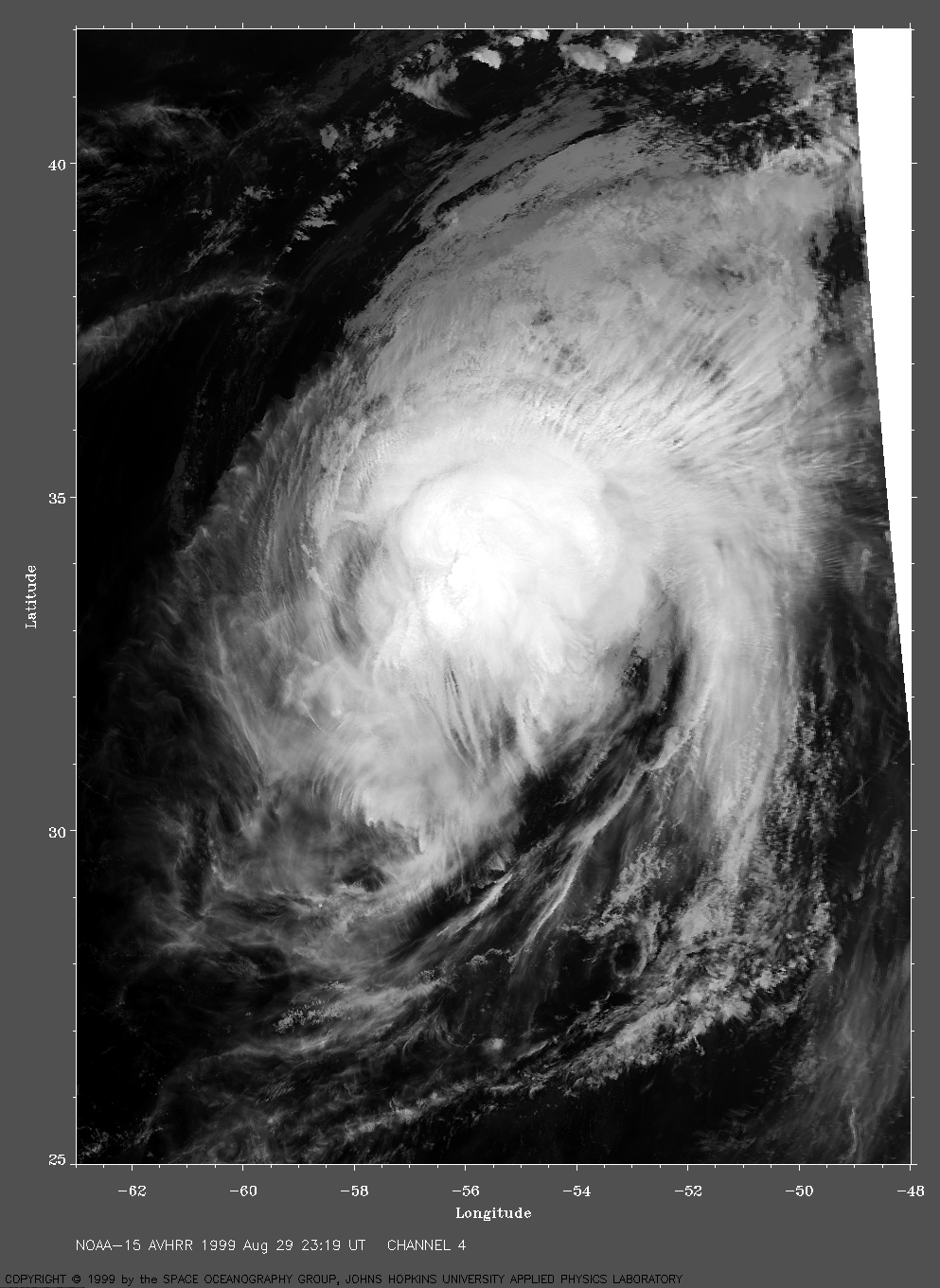
 1999 August 30 08:31 UT
NOAA-14
AVHRR channel 4 early morning image. A closer view (181 Kb)
is seen by clicking on this small image.
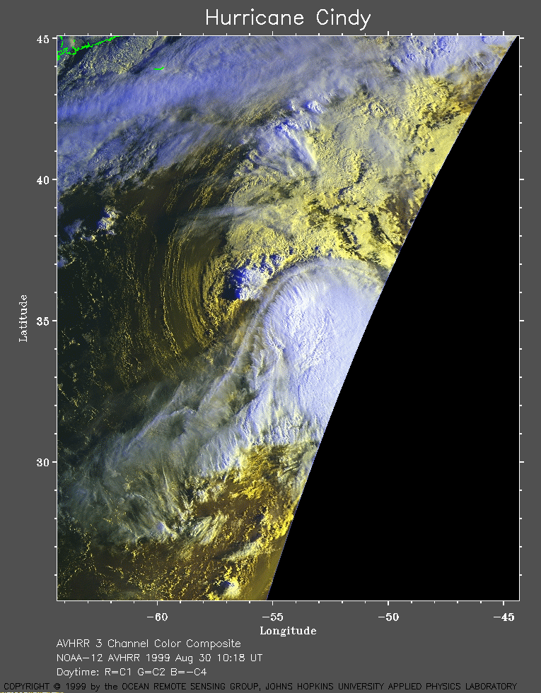 1999 August 30 10:18 UT
NOAA-12 AVHRR 3 channel color composite daytime image. A closer view (318 Kb) is seen by clicking on this small image.
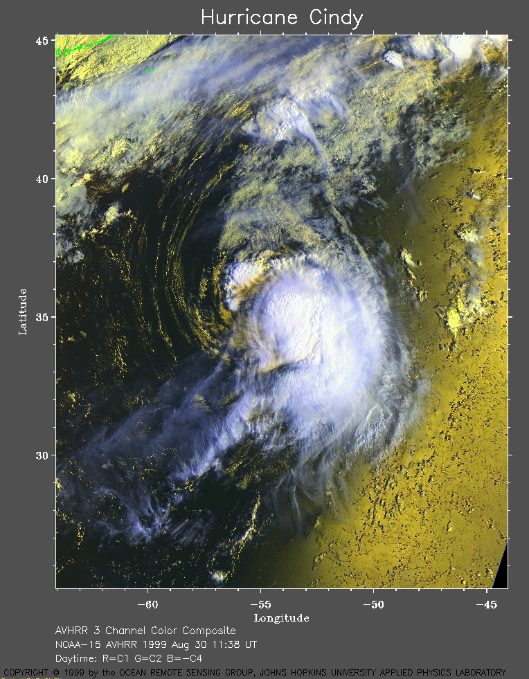 1999 August 30 11:38 UT
NOAA-15 AVHRR 3 channel color composite daytime image. A closer view (429 Kb) is seen by clicking on this small image. A very large image (647 Kb) is also available.
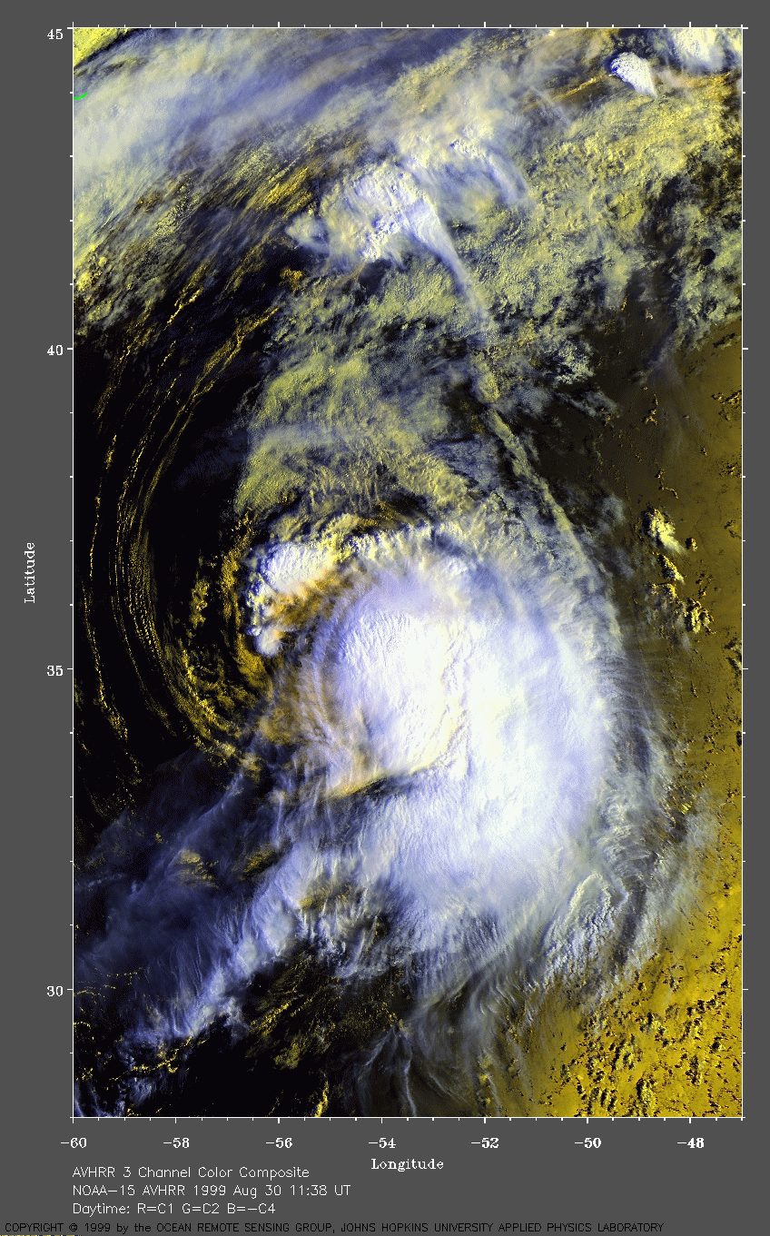
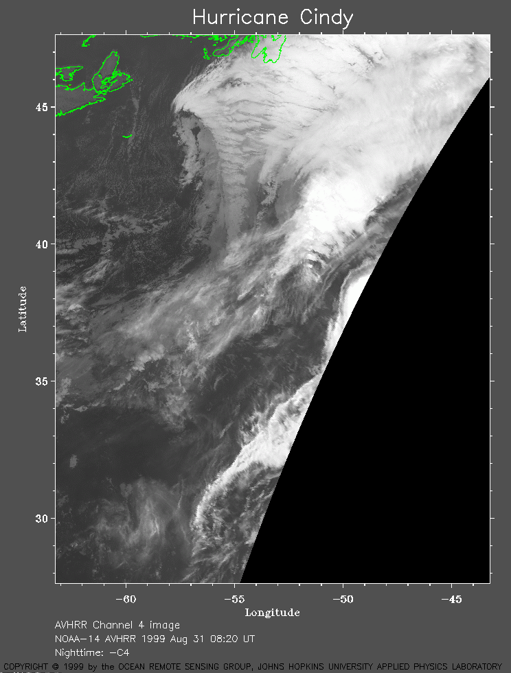 1999 August 31 08:20 UT
NOAA-14 AVHRR channel 4 early morning image. Only the western edge of Cindy is visible. Cindy is becoming associated with a large extratropical low seen near the top of the image. The maximum sustained winds have decreased to 80 mph. A closer view (203 Kb) is seen by clicking on this small image.