Introduction
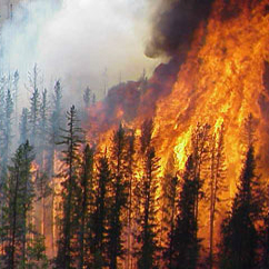
The boreal forest zone, composed primarily of conifer trees
north of 45 degrees, covers an area of 12 million km2 and accounts for 25 percent of
the world’s forests. This zone is subject to large, intense fires that burn an
average 2.4 million ha annually in Canada and as much as 22 million ha globally in a
single year.
Wildfires are a dominant influence on the boreal biome, controlling successional patterns, primary productivity, and carbon cycling. Boreal fires also inject large amounts of trace gases and smoke aerosol into the atmosphere, both of which influence the Earth’s radiation budget. Considering the remoteness and vast extent of the boreal biome, satellite remote sensing is particularly well suited to documenting the spatial and temporal distribution of fires so that these impacts may be quantified.