Area-averaged Extreme Temperatures in Maryland:
January 1 - December 31, 2024
This analysis identifies Hot Days as those whose daily maximum temperature is larger than 86°F; Warm Days (summer days in the literature) as those whose daily maximum temperature is larger than 80°F; and Warm Nights (tropical nights in the literature) as those whose daily minimum temperature is larger than 68°F. If these days/nights occur for two or more consecutive days they define a Heat Wave, a Warm Day Spell, and a Warm Night Spell, respectively. Summary tables can be seen in the following links for Hot Days, Warm Days, and Warm Nights.
NOTE: The plots are created from preliminary NCEI's nClimDiv-Daily data set, v1.0.0. Data labeled as scaled on January 10, 2025.
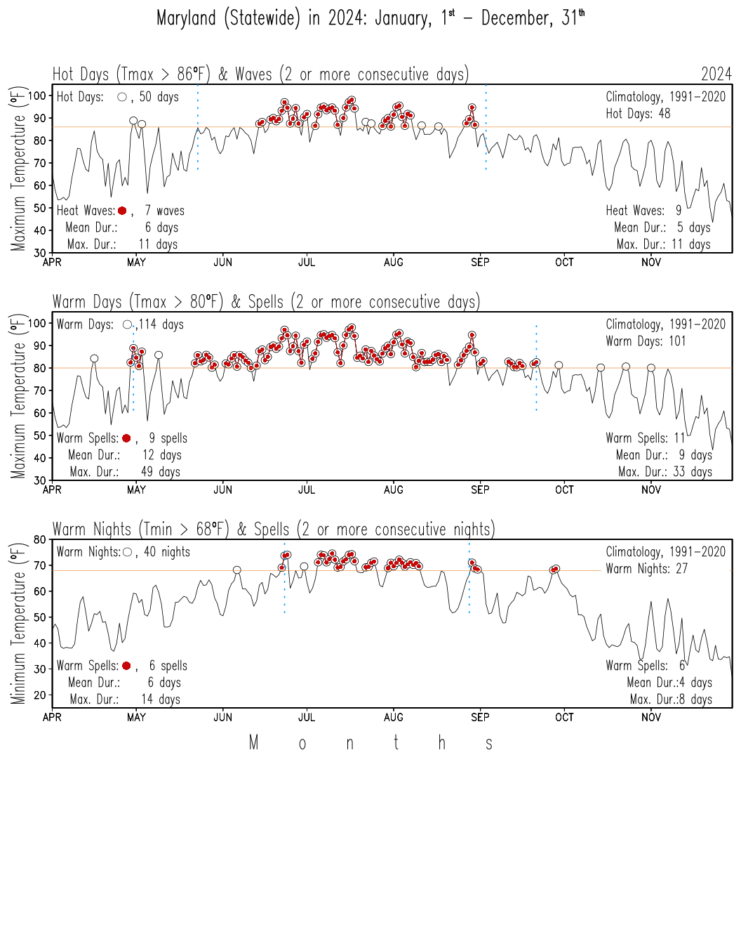
The upper panel shows hot days in open circles and heat waves in red-filled circles from daily maximum temperatures. The middle panel shows warm days in open circles and warm day spells in red-filled circles from daily maximum temperatures. The lower panel shows warm nights in open circles and warm night spells in red-filled circles from daily minimum temperatures. The continuous orange line in each panel marks the 86, 80, and 68°F threshold temperatures for each case. The vertical light blue dotted lines mark the 1991-2020 climatological start dates of the first and last waves and spells.