Track map
Bret developed from Tropical Depression 3 in the Bay of Campeche.
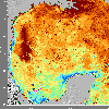
 7 day average SST image from 20 August
(338 Kb) This image is derived from the average composite sea surface
temperature (SST) data over 7 days ending 20 August 1999. The averaging
is done to remove clouds. The track of Bret is overlaid on this image.
Note how Bret rapidly intensifies as it crosses the warm eddy.
3 day average SST image from 24
August (380 Kb) This image is derived from the average composite
SST data over 3 days ending 24 August 1999. Note the prominent cool
wake left by Bret.
3 day average SST image from 25 August (342 Kb) Note how Bret's cool wake is now slowly dissipating.
Track file
Track data (lat/lon, winds, etc.) in a text file.
