Modeling the Messinian Salinity Crisis:
Since warm
air rises and cold air sinks, the high temperatures cause air to
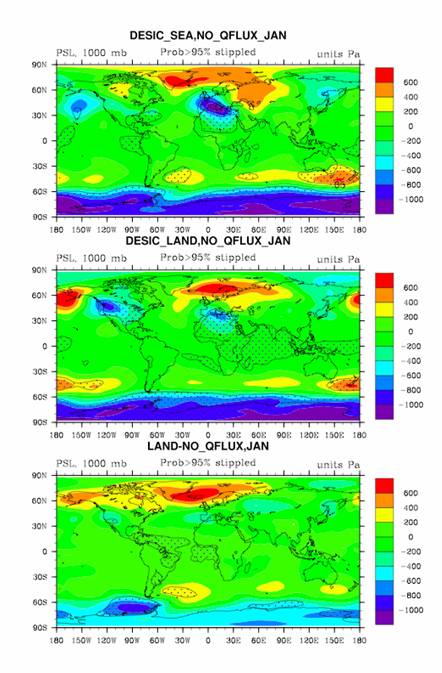
rise over the lowered Mediterranean Sea. A strong region of lower
than normal pressure develops over the Mediterranean region and
Western Europe (Fig. 3) in the LS case. Rising air leads to
abnormal low-level wind convergence over
the hot lowered basin in response to the warm, rising air. In this
region, the sea level pressure is reduced up to 1000 Pa and is
spread from the Mediterranean Sea northwestward into France and
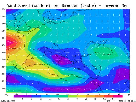
Spain (Fig. 3). By contrast with the usual primarily zonal winds in
the Mediterranean, the LS wind vectors show a strong southerly wind
component over the central and eastern Mediterranean Sea (Fig. 4)
for the LS case. This southerly wind pushes air up the slope of the
northern edge of the basin. Remember at the edges of the dried up
basin there are large sloping land surfaces. The upslope flow and
convergence leads to higher levels of precipitation in the
Alps.