Maryland Climatology
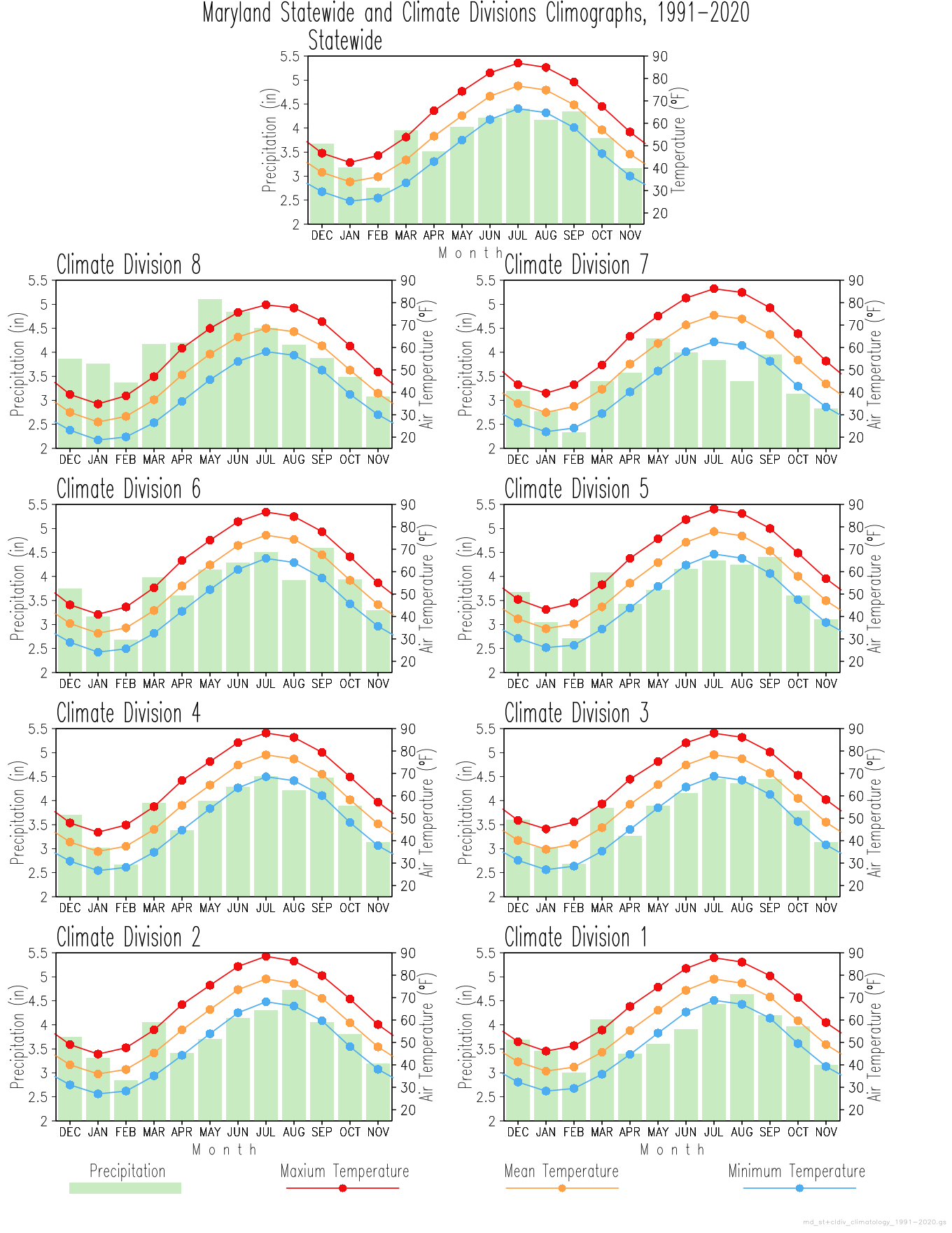
Every place on the planet has climate characteristics that distinguish it from other places. A climograph is graphical tool used to describe the climate of a given place, in terms its temperatures and precipitation, and compare climates in various places.
The data set used in the plots displayed in this page is NOAA's Monthly U.S. Climate Divisional Dataset (NClimDiv, Vose et al. 2014). This data set provides area-averaged mean values at Statewide, Climate Division and County level at monthly resolution for the period 1895-present.
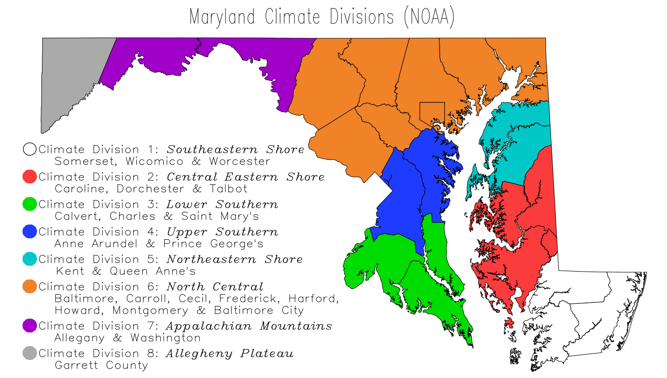 It is necessary to clarify that the term Climate Division refers to one of the 8 divisions in the state that represent climatically homogeneous regions, as determined by NOAA. The 8 Climate Divisions, and corresponding counties, in the state are shown in the map to the left according to the color legend.
1991-2020 Monthly Climographs
- Statewide and Climate Divisions
- Counties